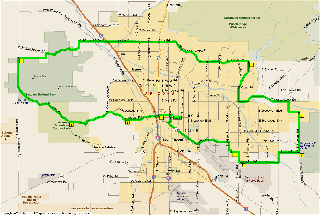
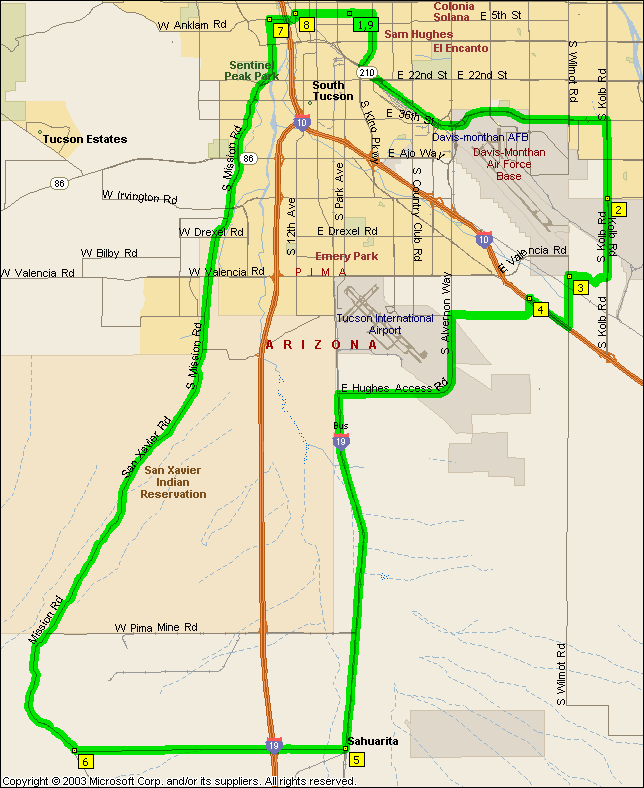
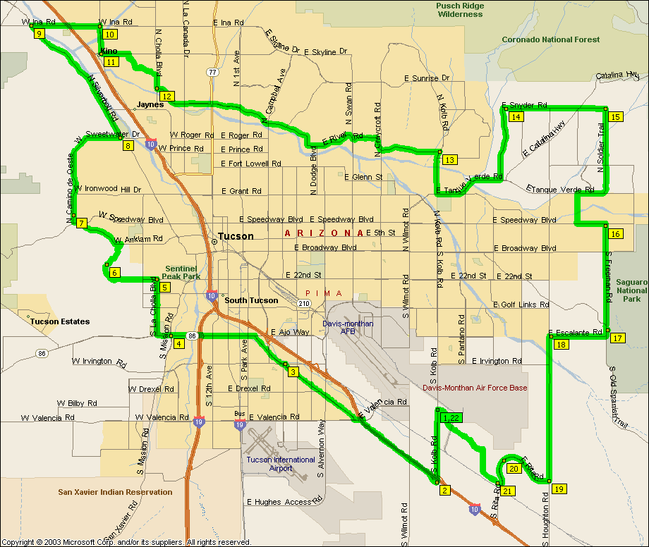
Alas, we're no longer riding on a regular basis.
No, it's not a ride, the pins are the public restrooms and fountains we use. Not that there aren't a million Circle K's and so on around Tucson and it's
environs that you can't stop at (the red flags are the outlying stores we use) but if you're riding by yourself it can get a
little awkward wheeling your bike into them, let alone their restrooms. So if you have a favorite
water fountain or outlying store
that's not here don't hesitate to send me a heads up at jforster@someplace.spam.dont.go.
|
|
| |
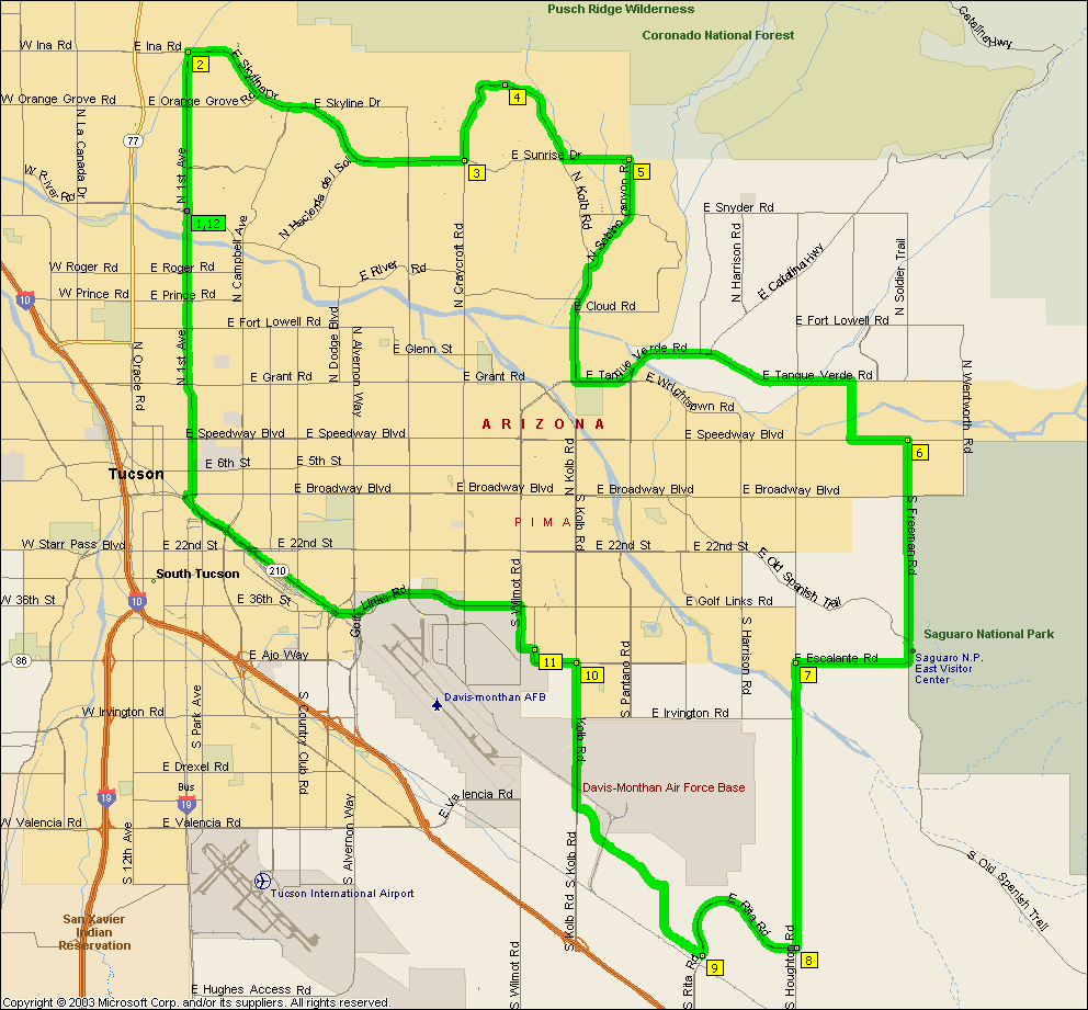
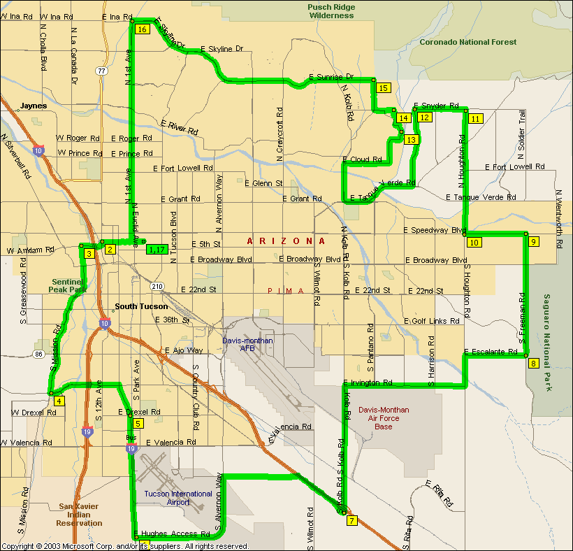
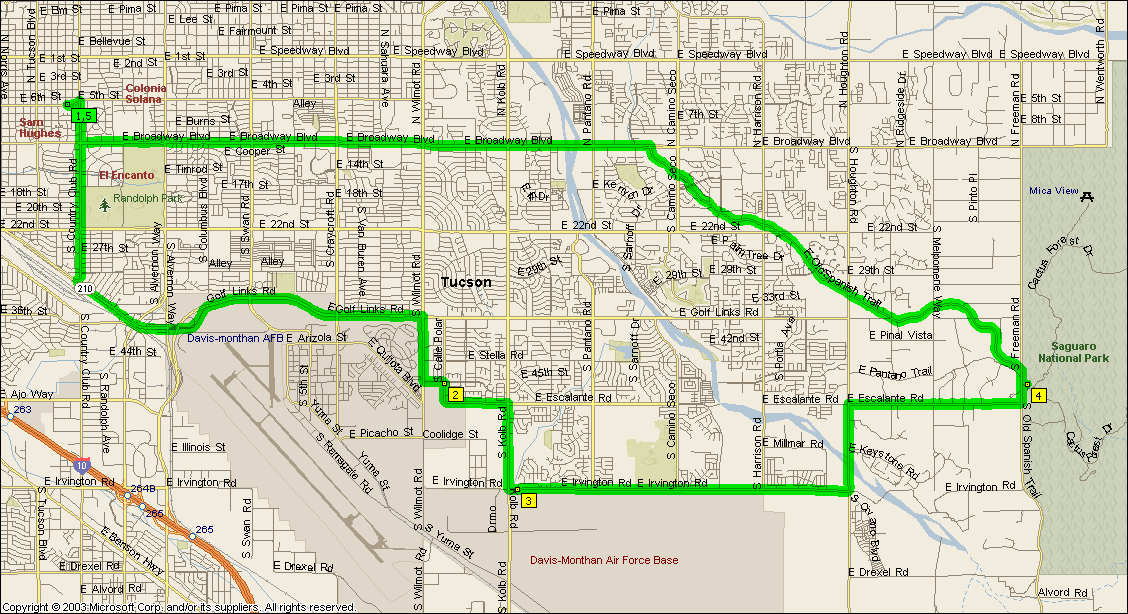
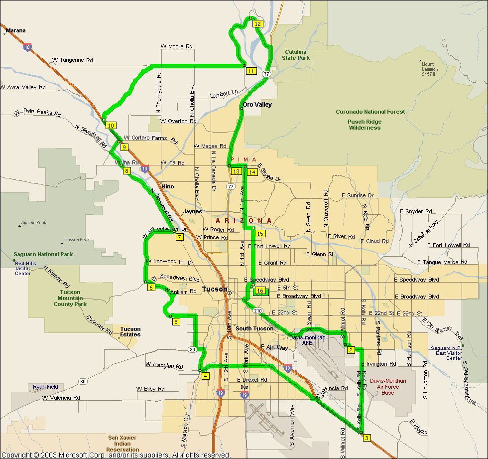
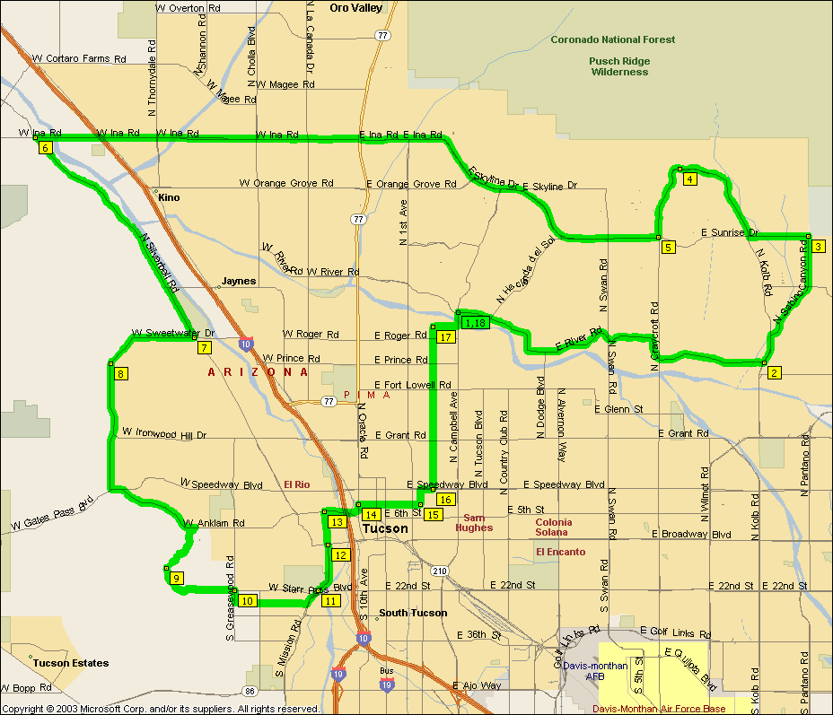
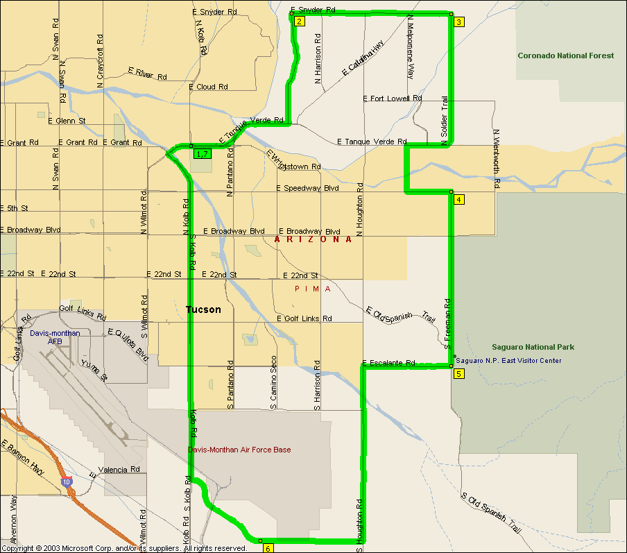
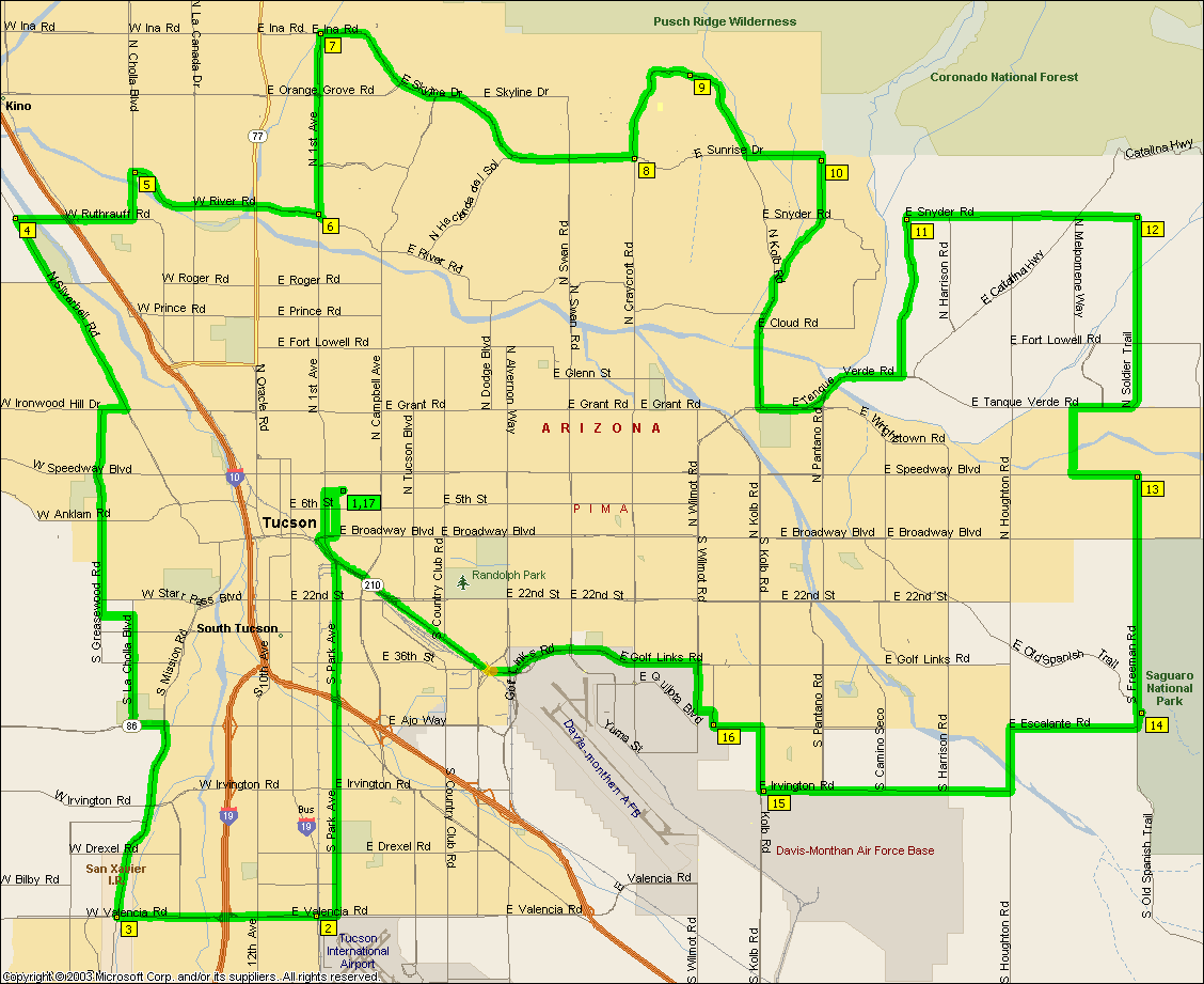
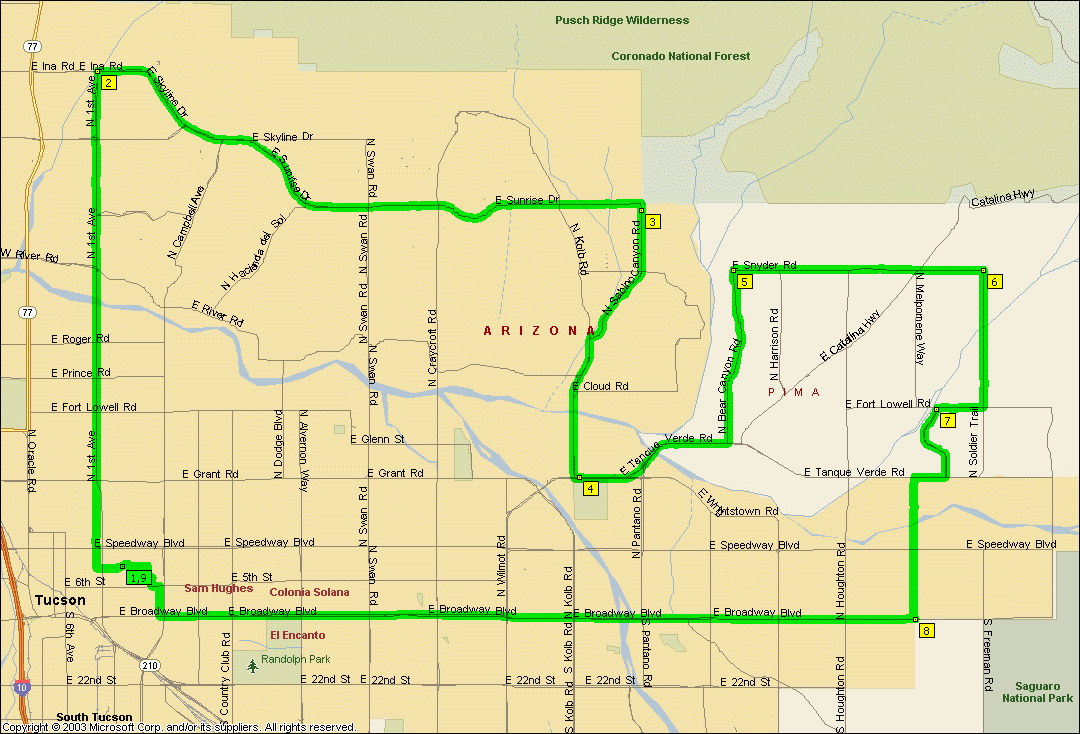
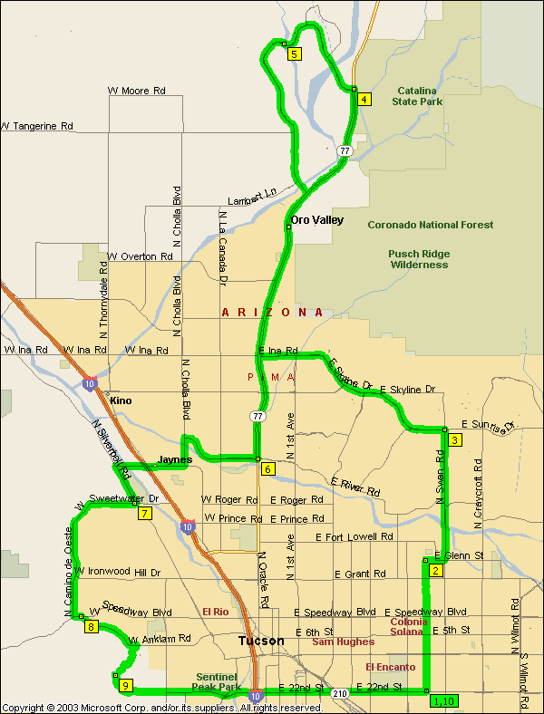
Looks easy but it's actually a tougher little ride that would appear. While
climbing First and Sunrise is no biggy doing the Kolb loop backwards having to
climb Craycroft first is serious. And then there's climbing Freeman after it.
A nice serious ride with the steepest damned hill around the place (excluding the
far side of Gates Pass of course ;) See
Golf Links Snyder Sunrise
for a anti-clockwise variant of this.
NOTE: It's not intended that you ride Aviation Parkway, you
should get on the bike path at Kolb and Escalante, cross over to the path on the
far side of the intersection at Craycroft and Golf Links and get off it at Highland and head north for campus.
|
|
|
|
|
| |
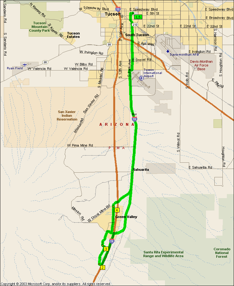
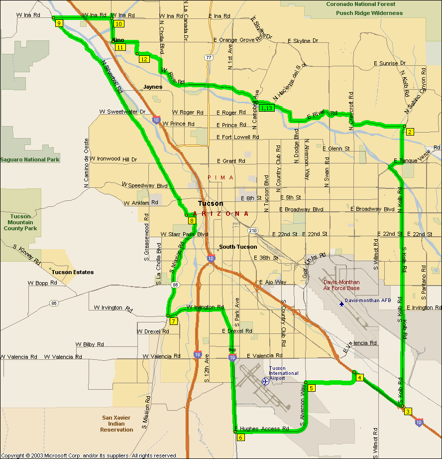
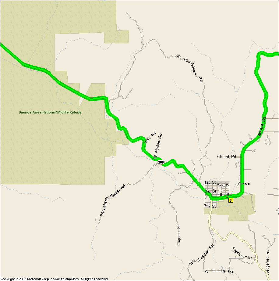
A nice moderate if very long ride through lots of different scenery past
three different mountains, a pretty cool ride IMO. No hills to climb
beyond a bunch of roller coaster type things unless you ride it clockwise. There's a 45
mile stretch from Three Points to Arivaca without so much as a place name to
ride through (beyond the wilderness areas anyway) so it's probably getting into real life threatening territory there
-- like that ever stopped us but I'd say it's a three person minimum ride.
Might not be possible in the summer unless you can carry more than three bottles
of water. Water in Arivaca appears to be the coffee shop on the East side
of town.
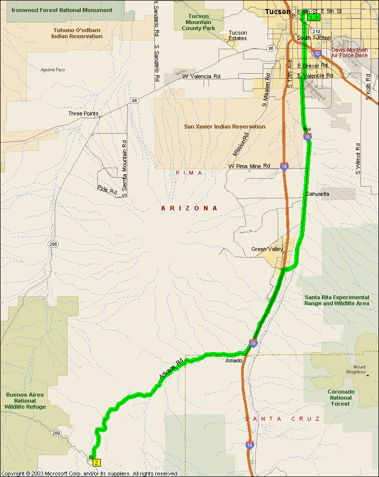
If the whole ride looks a little much then the
Green Valley side to Arivaca can be ridden by itself for a slightly saner
120.6 mile ride. A relatively moderate 20 mile climb (and rather pretty piece of road)
from Arivaca Junction to Arivaca amplified by a bunch of rolling hills and other
repeated ups and downs is this ride's prime feature -- the rest of it is rather
unremarkable other than the distance you cover. Still well worth the ride
just for that 20 miles, hell, there's even one section of Arivaca Rd. that's got
enough trees lining the road so that you actually get shadows on the road --
almost unheard of around here unless you're half way up a mountain...
|
|
|
|
|
| |
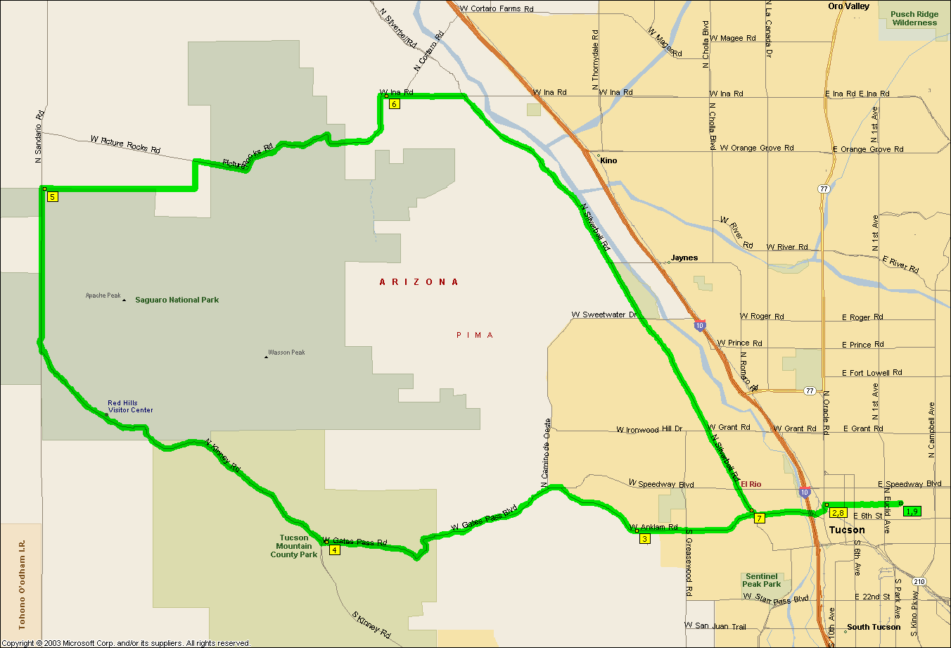
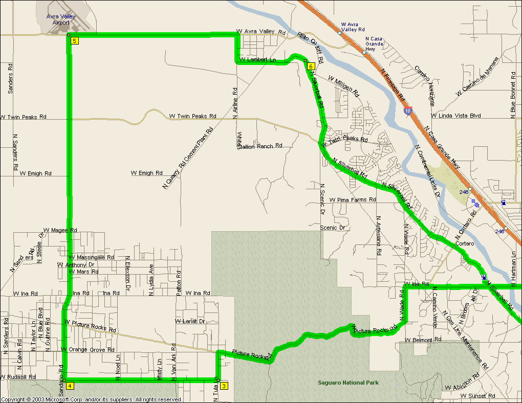
A nice ride out of Udall Park with a little bit of climbing over Picture
Rocks. Just ridden
from the UofA it's a
50.0 mile ride.
|
|
|
|
|
| |
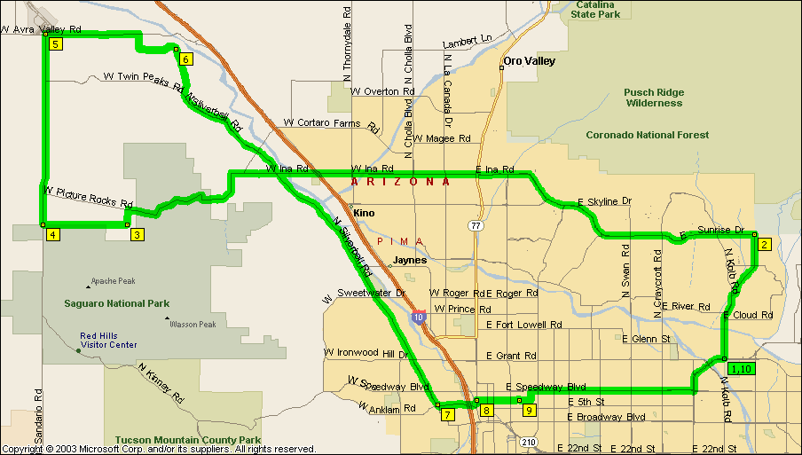
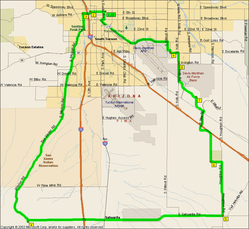
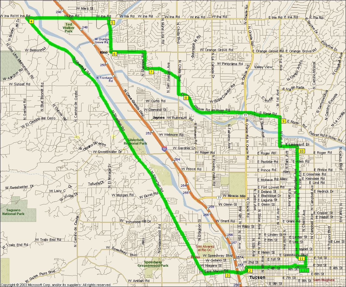
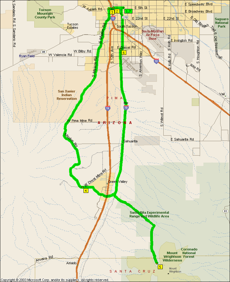
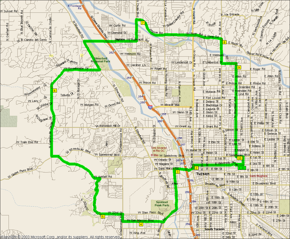
This is your basic solo Tucson bike ride, solo because it doesn't require
someone else to mind your bike when you stop to tank up. Starts out nice
and easy down Silverbell and slowly lets you work up to the hills. It's
got amenities all over the place for bladder breaks and water (Silverbell Park
at marker 4 if you start someplace other than the UofA campus, Ventana Canyon just
north of marker 6, Agua Caliente Park out Roger Rd at marker 8 and Saguaro
National Monument at marker 10 plus numerous fountains along the Aviation
bikeway).
If the
basic ride isn't enough
adding Starr Pass, the Kolb Loop and Rita rd. takes it out to
89.4 miles. There's another park there
between marker 17 and 18 on the south side of Rita Rd.
And then of course there's the
Short Perimeter at 85.1 miles and the
Short Perimeter with Barrio at 85.7 miles
(although riding along Valencia sucks so you might want to cut the Barrio off at
Irvington).
NOTE: It's not intended that you ride Aviation Parkway, you
should get on the bike path at Kolb and Escalante, cross over to the path on the
far side of the intersection at Craycroft and Golf Links and get off it at Highland and head north for campus.
NOTE: It's not intended that you ride that mess of back streets along River
between La Cholla and Orange Grove, River actually gets through these days
(MapPoint isn't up to date), just keep going along River...
|
|
|
|
|
| |
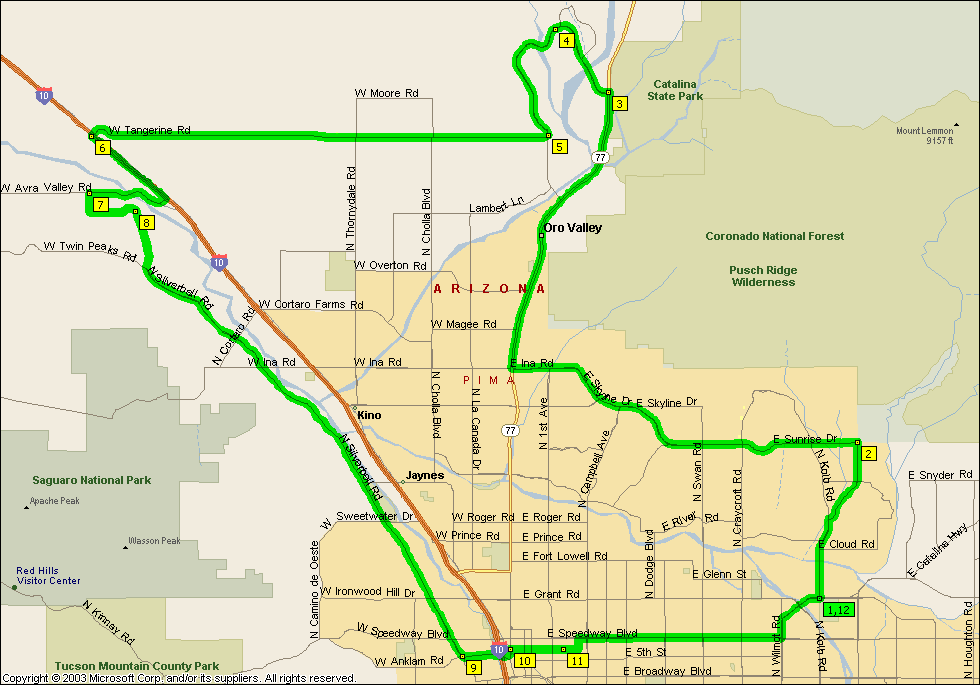
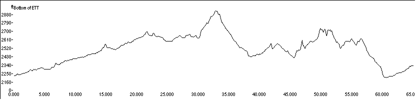
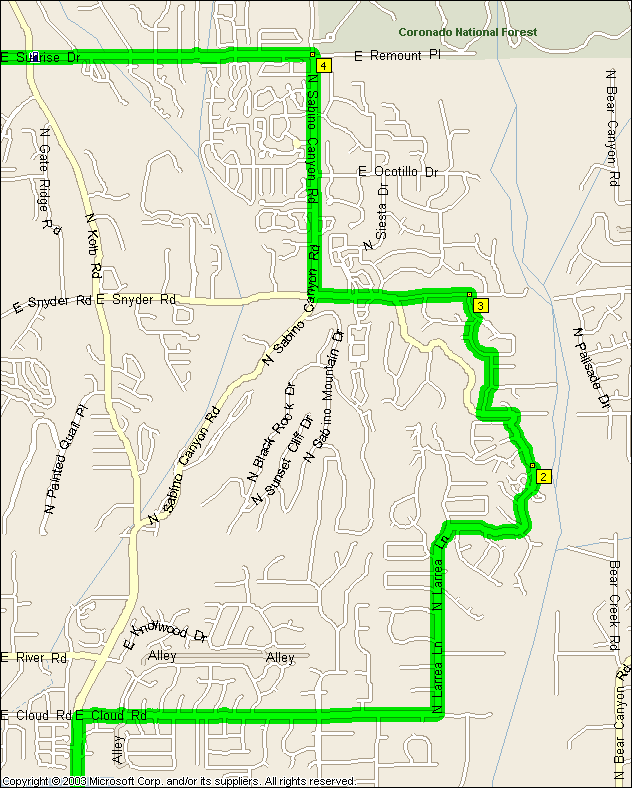
This one's training for getting up Snyder after having ridden first 55 odd miles of El Tour de Tucson.
When you take the detour down Cloud Rd, Larrea Ln. etc. you'll come across Canyon Ranch gates, you should be able to
call security and ask if you can ride you bikes through to Rockcliff Rd. Good luck winding through Canyon Ranch though if you don't take the first security gate as indicated on the map,
them's some twisty small little roads in there.
If you add a Rancho Vistoso Loop onto the end of this ride like the
Hills of El Tour then it's 100.3 miles and will screw you up pretty much as
well as the real El Tour de
Tucson does seeing as most people have to ride to campus to the start the
ride like we do.
|
|
|
|
|
| |
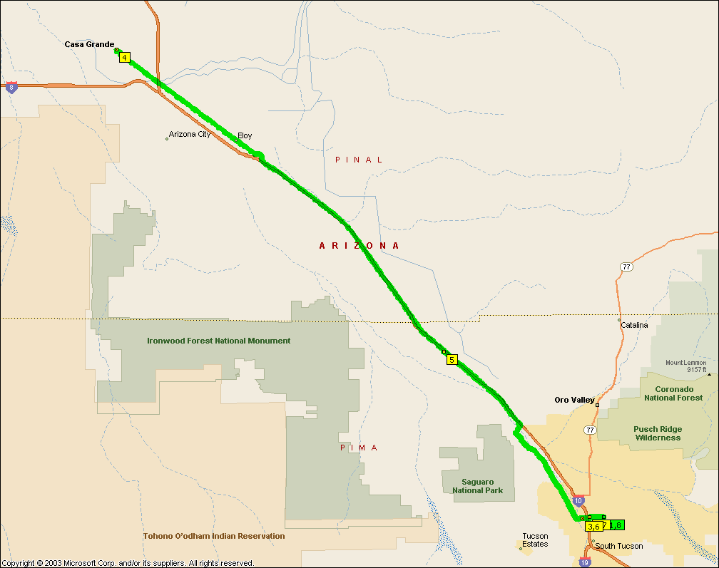
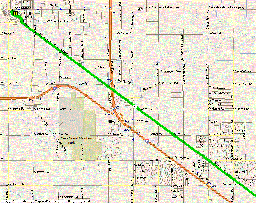
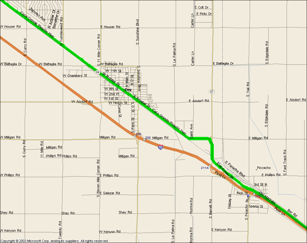
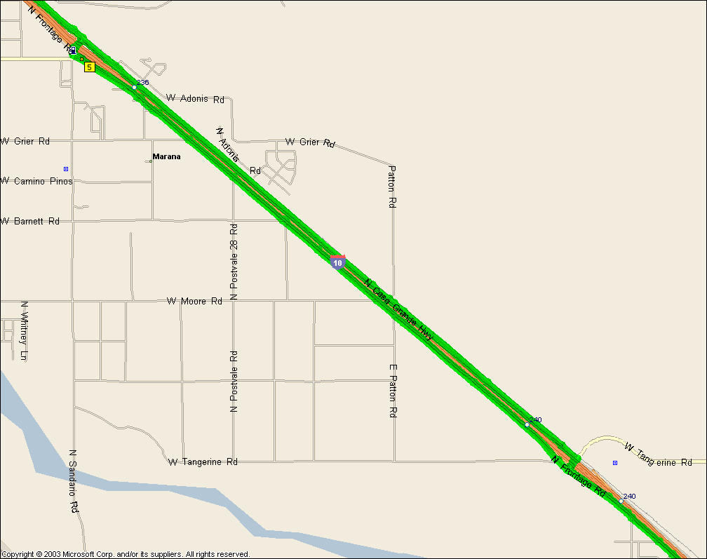
A real grind coming home, that's for sure. Prevailing SE wind and the
down hill to Casa Grande make for a high speed buzz that just goes and goes and
goes -- in a straight line. You can zone out for whole minutes and nothing
changes. And then there's the desert around Casa Grande, serious sand and
occasional tumbleweed desert, scary -- definitely a ride to do in a group that's
for sure. Coming home is miles and miles of uphill into a breeze (more
than like), ohh is that serious...
Note, you can dispense with Silverbell these days, the frontage
roads have all been completed and while there are a lot of stops the road
quality is substantially higher than Silverbell and they've got
really wide bike lanes down them. You do of course have the entertainment of
interacting with traffic exiting from I-10 so it's not all good news...
You can always bail and turn around at
Picacho Peak for a much easier 83.0 mile affair
of course.
|
|
|
|
|
| |
A fairly moderate ride, smooth gradients for the most part. One of my
favorites when ridden clockwise if I'm not out to kill myself. If you
start out down I-19 it's a 58.5 mile ride. A slightly
longer ride that avoids Houghton is the
Alternate Triangle ride.
NOTE: It's not intended that you ride Aviation Parkway, you
should get on the bike path at Kolb and Escalante, cross over to the path on the
far side of the intersection at Craycroft and Golf Links and get off it at Highland and head north for campus.
|
|
|
|
|
| |
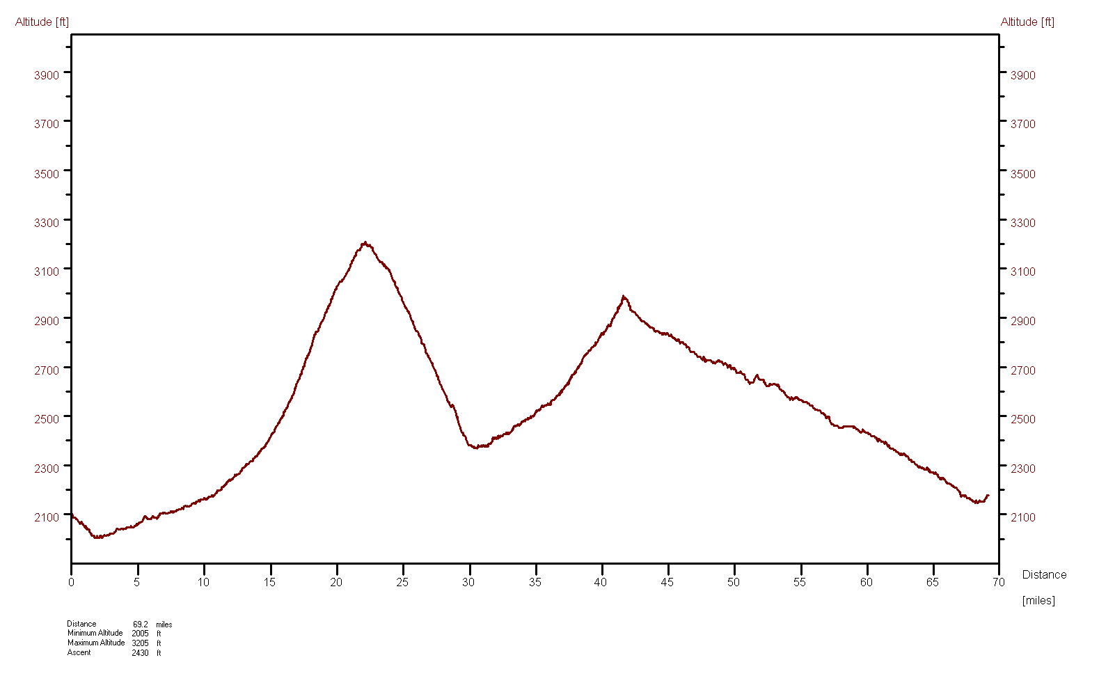
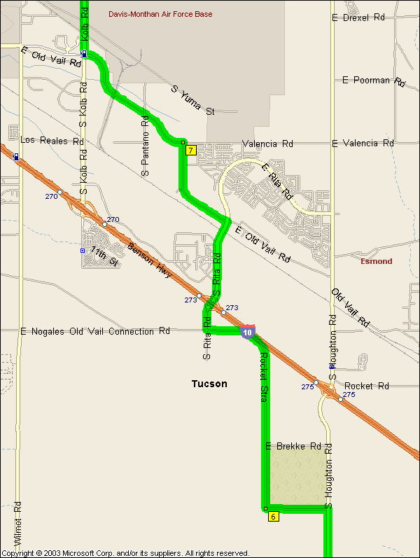
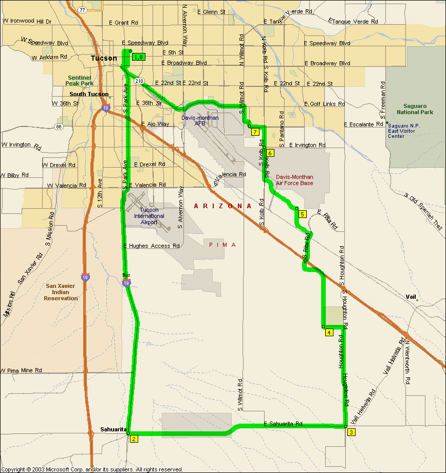
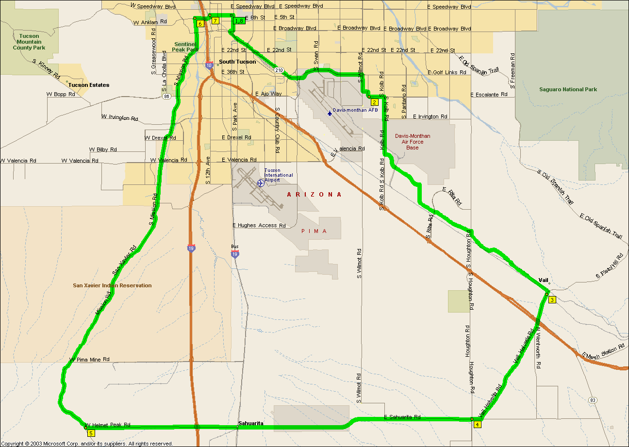
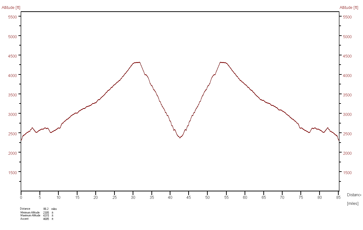
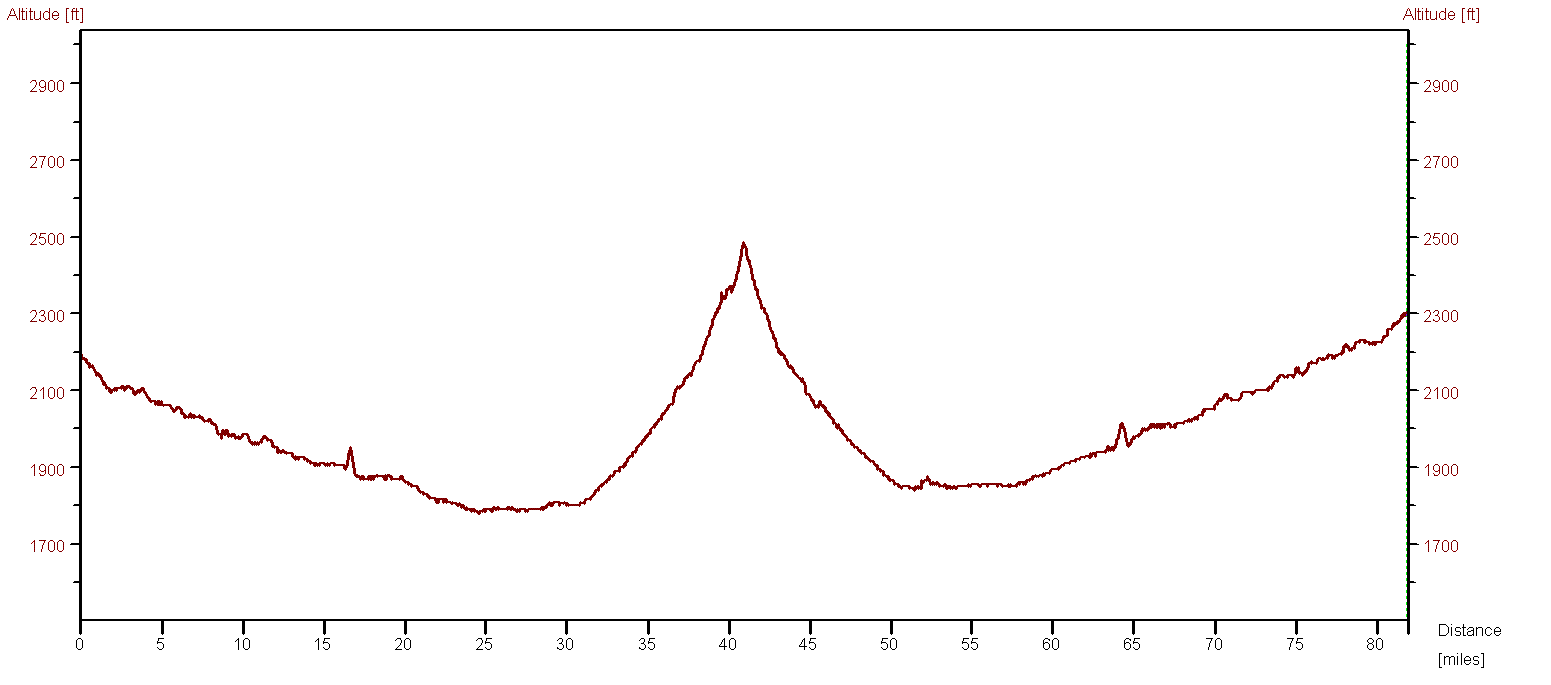
So Eric and I are out there checking out the new start/finish line for the
2005 ETdTM and OMG! There really is something out there, there's this nice
civic center out in the middle of all these fields. Go figure. At
least you can get water at the park that's there and I'll bet the grass makes a
nice break if you're out there when it's really hot in the summer.
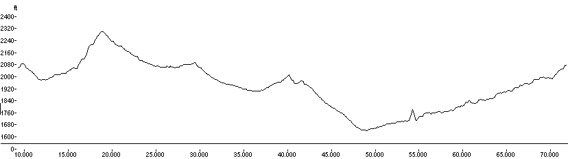
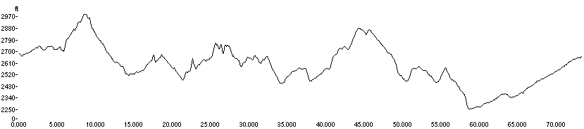
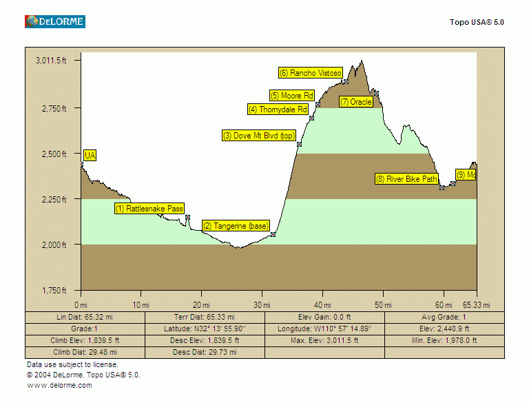
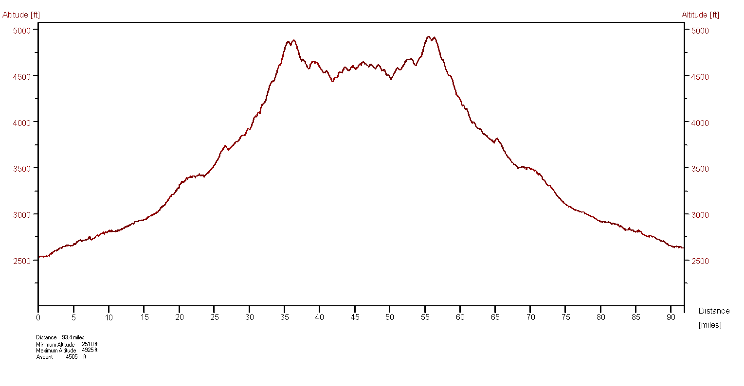
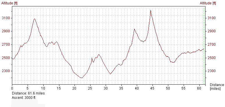
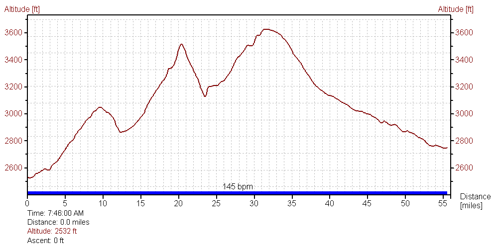
Our
old training ride was only 63.3 miles and it's
the one
the elevation data is on.
|
|
|
|
|
| |
This is about as flat a 55 mile ride as you can get in Tucson (with one
possible exception out near Sahuarita) and not go round in small circles.
People say this place is flat, well I'd say they obviously don't ride bikes.
For a really easy ride do this in the morning in reverse (clockwise), prevailing
wind conditions will usually be with you for most of the ride.
NOTE: It's not intended that you ride Aviation Parkway, you
should get on the bike path at Kolb and Escalante, cross over to the path on the
far side of the intersection at Craycroft and Golf Links and get off it at Highland and head north for campus.
NOTE: It's not intended that you ride that mess of back streets along River
between La Cholla and Orange Grove, River actually gets through these days
(MapPoint isn't up to date), just keep going along River...
|
|
|
|
|
| |
A standard route that loops around the prettier neighborhoods in Tucson.
The
shorter route is 49.1 miles.
|
|
|
|
|
| |
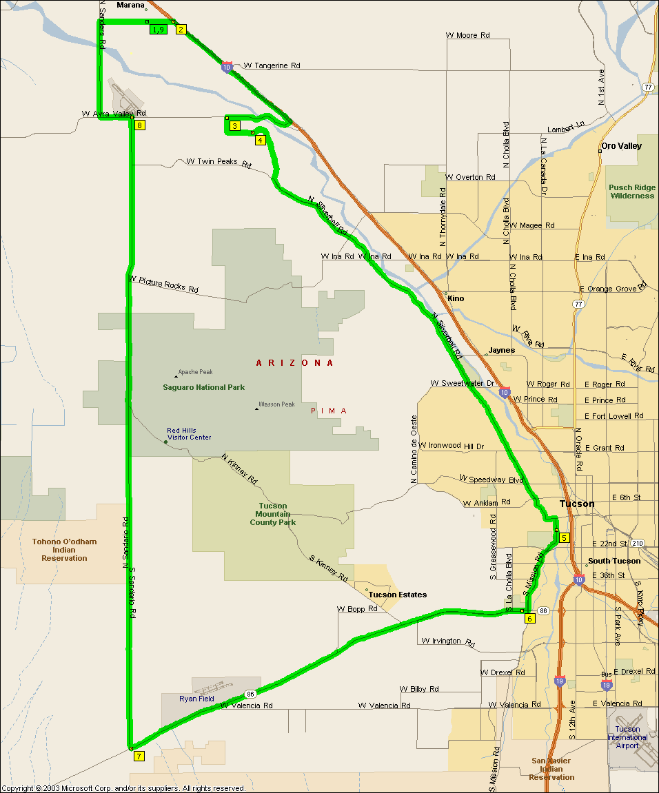
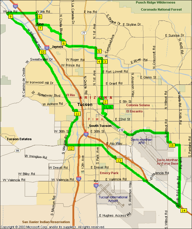
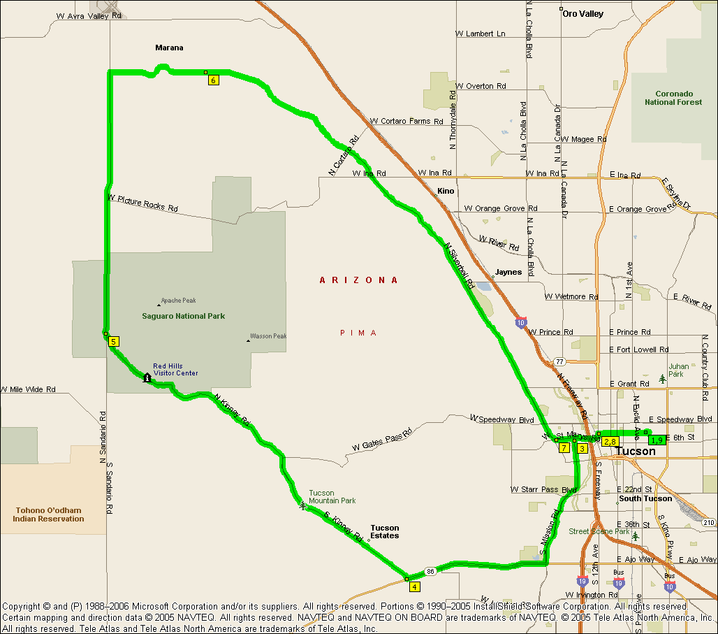
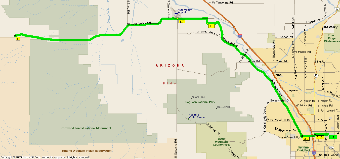
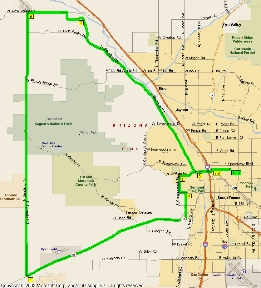
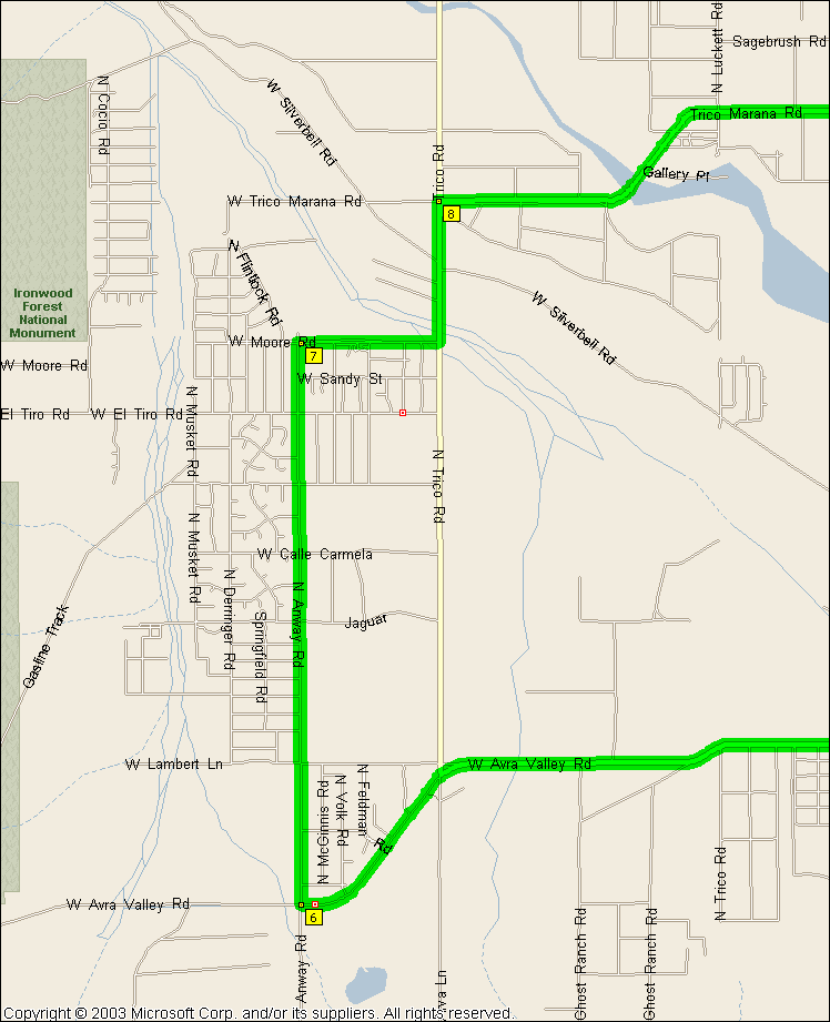
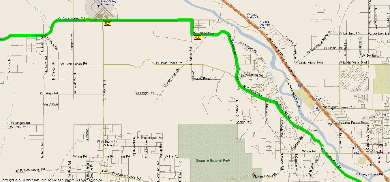
So I wanted to see what was in Avra Valley one day as there's a Tour de Avra
Valley I heard about somewhere. Will said Marana was out there.
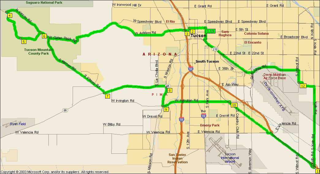
Experience led us to believe otherwise. Gates Pass is excellent and cruising down Sandaro is always fun even if Silverbell can be a little work coming home
as it's usually into the wind.
Since we first rode this we found the convenience
store at Anway when riding
West
Silverbell as opposed to the ghost
town on Sanders so we stretched the ride to go up Anway instead of Trico.
And then wonder of wonders we found a real honest to god civic center checking
out the new
El Tour de Tucson Mountains start/finish line, Marana really does exist.
|
|
|
|
|
| |
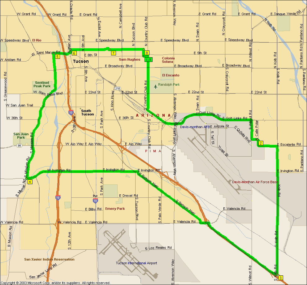
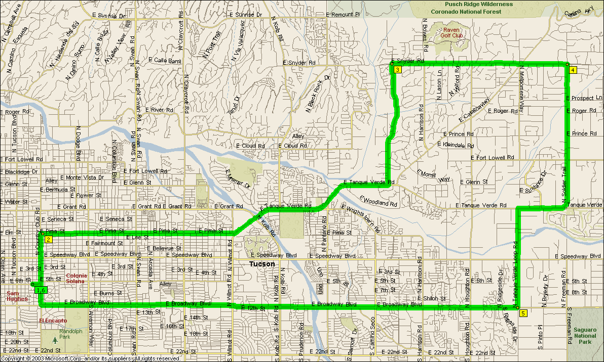
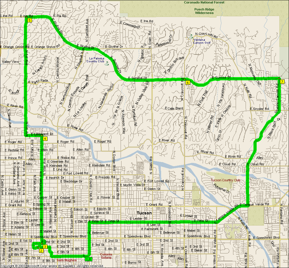
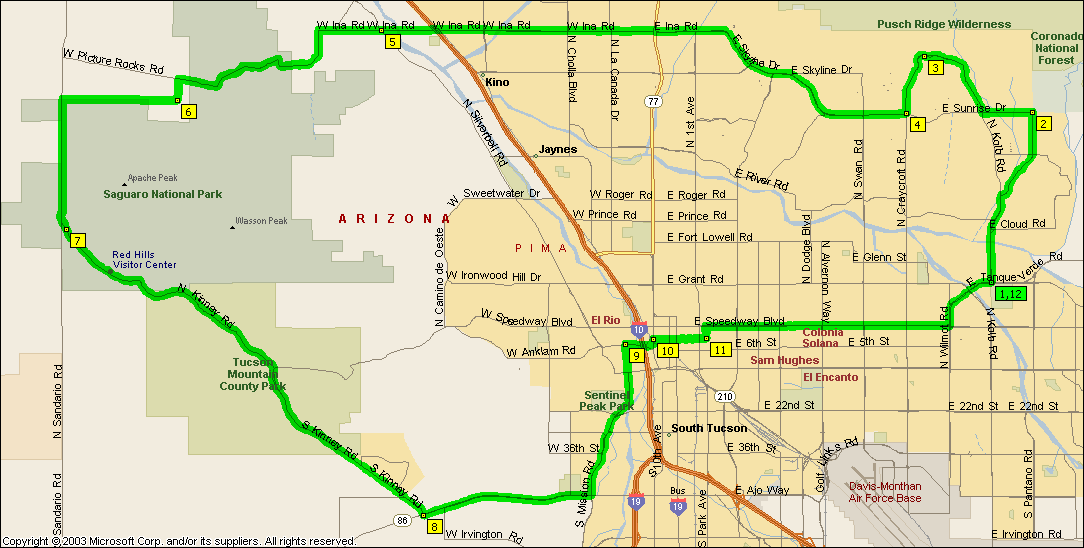
Never been particularly wild about the Golf Links part this ride, we tend to
skip the Aviation Bikeway and Golf Links and just use Broadway instead or ride
the 69.8 mile
extended version.
See
1st Sunrise Freeman for clockwise version of this.
NOTE: It's not intended that you ride Aviation Parkway, you
should get on the bike path at Wilmot, cross over to the path on the
other side at Craycroft and Golf Links and off it at Highland for campus.
|
|
|
|
|
| |
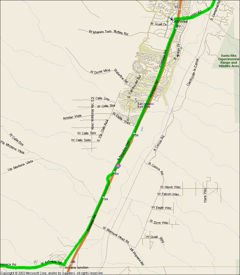
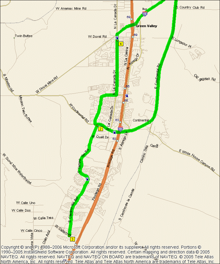
Flat and boring for the most part. But then some days you just want a
flat and boring ride, so...
Actually it was pointed out to me recently that the Frontage road between Continental and Calle Tres is getting a fair bit of traffic these days
so those more inclined to safety on their rides might want to take Camino Del
Sol from Continental Blvd and
just turn around and ride back up it when they get to Calle Tres.
|
|
|
|
|
|
| |
The top of Silverbell is probably best left for the more experienced rider --
at least till they repave the thing which is supposed to happen some time soon.
NOTE: It's not intended that you ride that mess of back streets along River
between La Cholla and Orange Grove, River actually gets through these days
(MapPoint isn't up to date), just keep going along River...
|
|
|
|
|
|
|
| |
NOTE: It's not intended that you ride Aviation Parkway or Golf Links etc, you
should take Country Club south and get on the bike path and take it east, cross over to the path on the
other side at Craycroft and Golf Links and off it Kolb and Escalante.
|
|
|
|
|
| |
NOTE: It's not intended that you ride Aviation Parkway or Golf Links etc, you
should take Country Club south and get on the bike path and take it east, cross over to the path on the
other side at Craycroft and Golf Links and off it Kolb and Escalante.
|
|
|
|
|
| |
You can also extend this out to
Sandario for a 48.7 mile ride.
|
|
|
|
|
|
| |
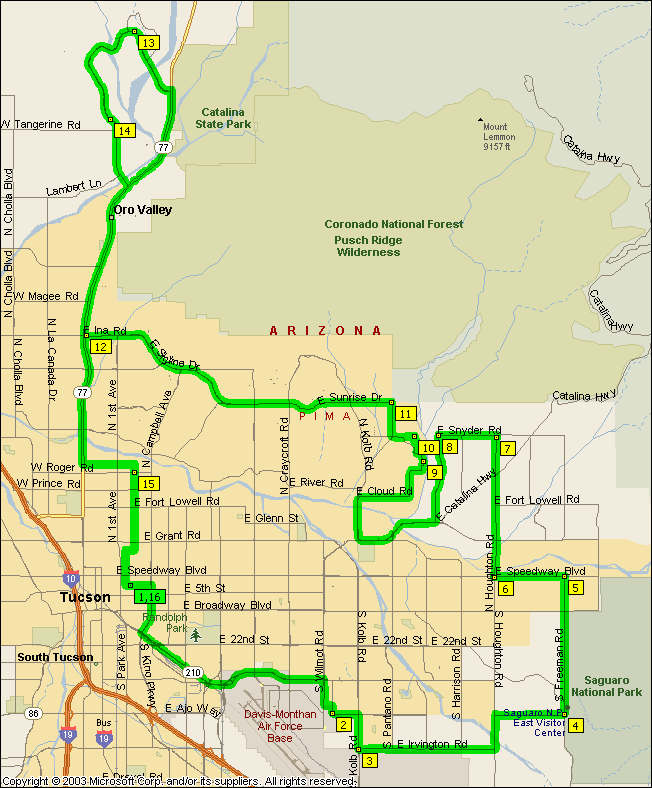
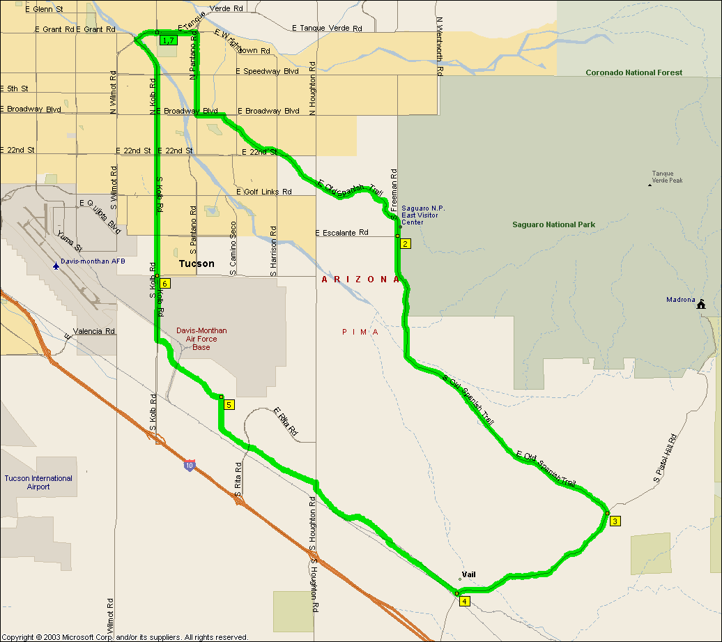
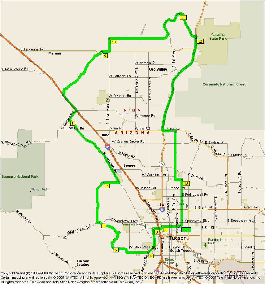
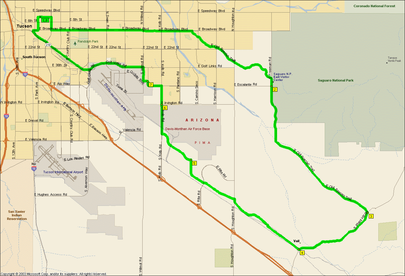
This one's got most of the hills you'll climb during El Tour de Tucson.
When you take the detour down Cloud Rd, Larrea Ln. etc. you'll come across Canyon Ranch gates, you should be able to
call security and ask if you can ride your bikes through to Rockcliff Rd.
Without the Rancho Vistoso loop it's 61.7 miles.
NOTE: It's not intended that you ride Aviation Parkway or Golf Links etc, you
should take Highland south from campus and get on the bike path and take it east, cross over to the path on the
other side at Craycroft and Golf Links and off it Kolb and Escalante.
|
|
|
|
|
| |
Nice alternative to other MegaHurtz rides if you want some Tucson Mountains
action but don't feel like going over Gate's Pass or Picture Rocks. Not
even remotely flat or anything as Kinney's non trivial and even Twin Peaks has a
little steeper section that I'd completely forgotten about...
|
|
|
|
|
| |
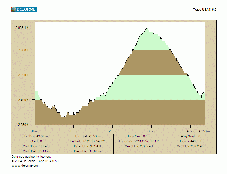
Well we finally actually worked up the guts to ride this one and there's no
doubt about what it should be named. Even though we've got some kick ass
rides in here this one is indisputably The Ride From Hell. Even if you
don't do it as the remnants of a hurricane hit town or have four flats. Something about 40+
miles of riding followed by an intense 10+ mile long relentless 7% grade hill climb I think.
And then 40+ miles home... Either ride to Kitt Peak, no probs, or ride up
Kitt Peak, a nice rigorous hill climb. But both of them combined, that's
in another league completely.
There's a convenience store at the San Pedro turn off
that's about 6 miles before the turn off to Kitt Peak to top up on fluid.
If it's summer you'll
need three bottles to get up the top after getting to the base of Kitt Peak even
if the top is 20 degrees cooler than Tucson as it's said to be. There's water in the picnic area once you get up the mountain.
We recommend multiple people here, Mountain Lions have
been seen up there...
But even if
it is The Ride From Hell Kitt Peak is still more fun to climb than
Lemmon is,
certainly a much more intense climb and the views are great. Some people
have the grade as 5% and maybe the overall figures they are using are right, but the
grade is 7%, take my word for it -- almost all of Kitt Peak is the same grade as the
steeper parts of Lemmon.
Of course you could just ride to the
San Pedro store and skip Kitt Peak for a nice little 71.5
mile ride.
|
|
|
|
|
|
| |
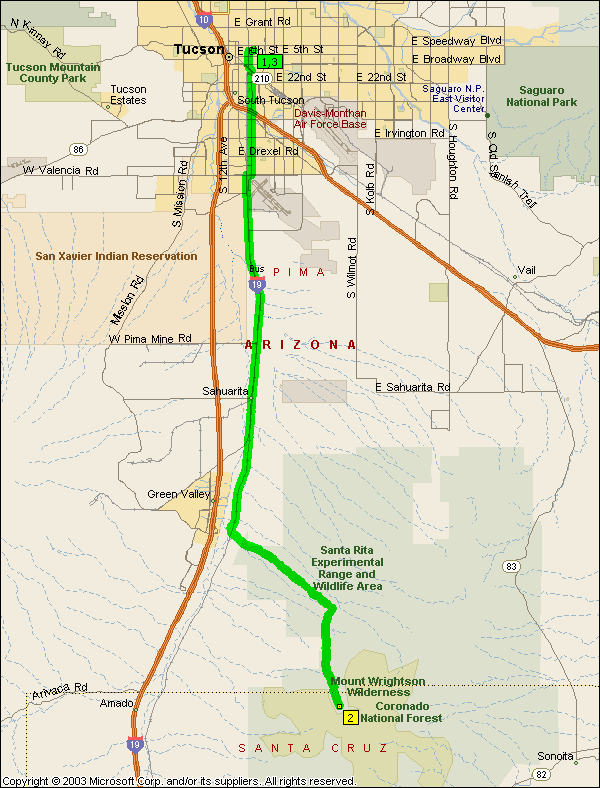
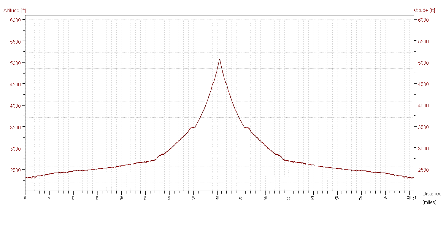
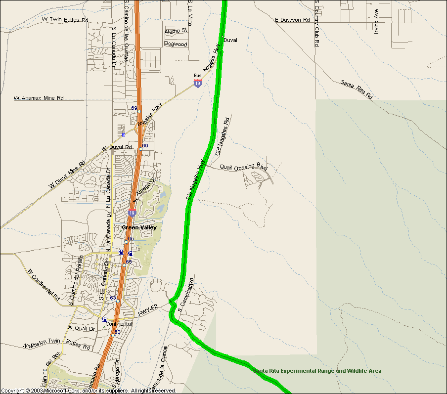
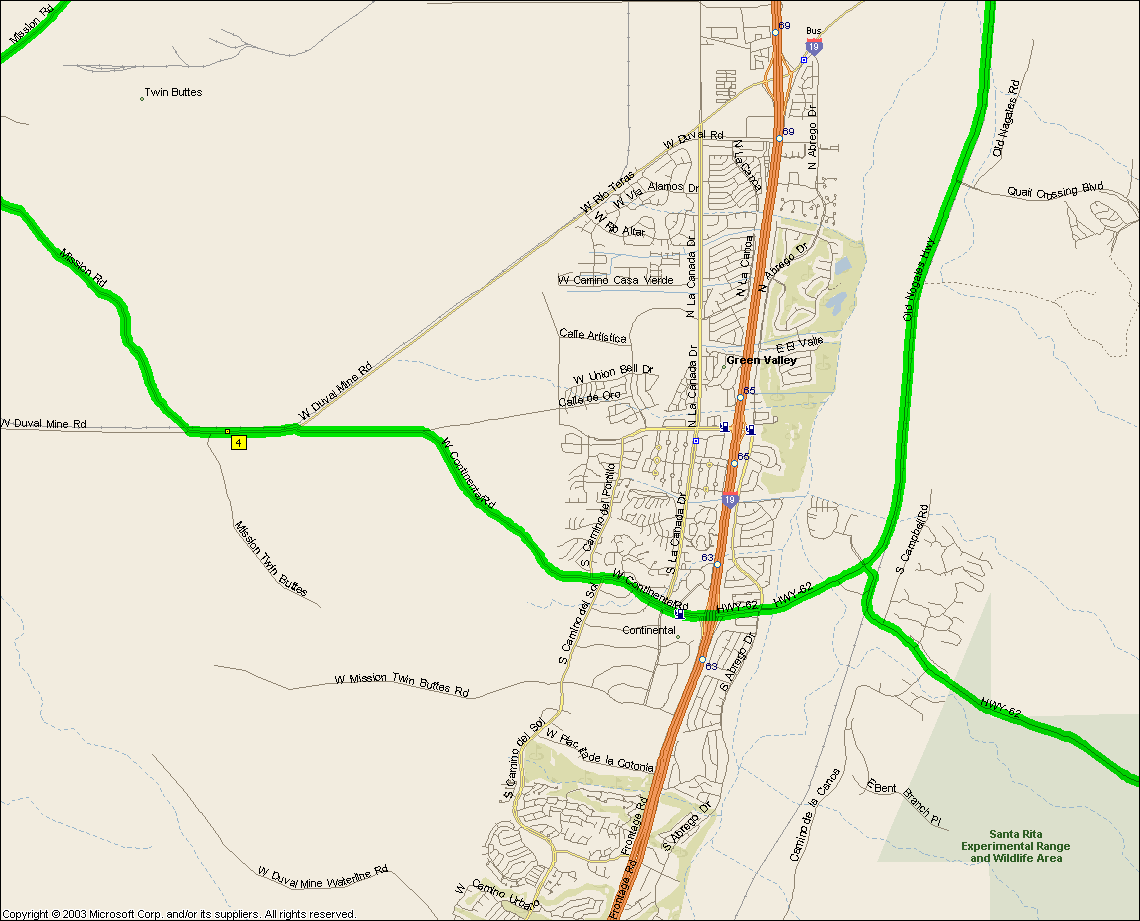
A nice gradually ascending ride out that keeps on getting steeper and steeper
and then it's down hill all the way home. Did this one by myself once in the
winter on a not particularly warm day, snakes alive was that miserable. It
just got colder and colder the higher up Madera Canyon I climbed to the point
where when I stopped up the top to eat a snack that I just scarfed what I had as
quick as possible -- had something to do with me crossing the snowline I'm sure.
But then the misery really began because at 40+ mph coming down I was even
colder to the point of uncontrollable shivering. However I couldn't slow
down, besides merely prolonging the suffering slowing down meant stopping
pedaling which of course meant I wasn't generating any heat... Ah, the
dilemma.
There's a school about a mile out of Green Valley once you make the turn onto
HWY 62 that has a water fountain round the back of its athletic facilities that
you can get to even if the school gates are all closed, otherwise the very top of Madera Canyon has water and restrooms.
We'll also run into Green Valley if it's hot for the gas station's ice that's on
the I-19 Frontage rd., it's only a mile or so out of the way.
|
|
|
|
|
| |
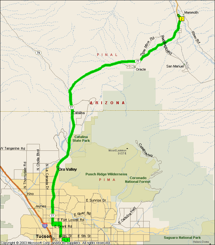
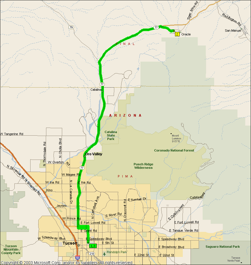
So Will says something like "Got some grades coming home, up to 7%" so I'm
thinking this one's in the
serious bracket. Ha, 4600' serious. For most of us just riding out to Oracle is
enough what with it being basically a 30 mile uphill ride -- but the usual theme
around here runs along the lines of what does not kill you makes you stronger.
So there you are having just cleared Oracle and are perhaps just a little bit
worn out when you see the sign "7% GRADES NEXT 12 MILES" and you're like "Do I
really want to ride down 12 miles of road that I'm going to have to climb
back up again when I'm already tired now?". Stupid question,
down we went. I was pleasantly surprised at how easy it was to climb back
up really, nothing like
Lemmon
or Kitt Peak.
A considerably easier ride of 71.7 miles is to
bail just before that "7% GRADES NEXT 12 MILES" sign and
turn around after stopping in Oracle.
|
|
|
|
|
| |
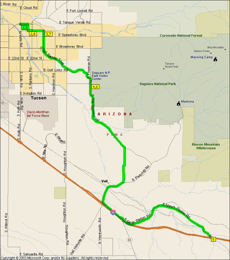
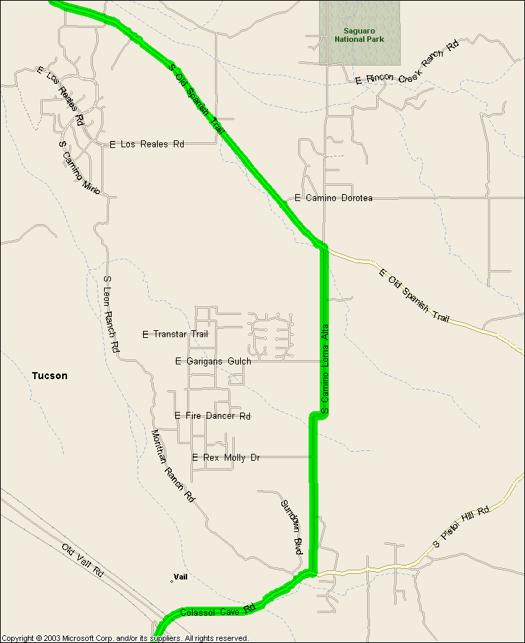
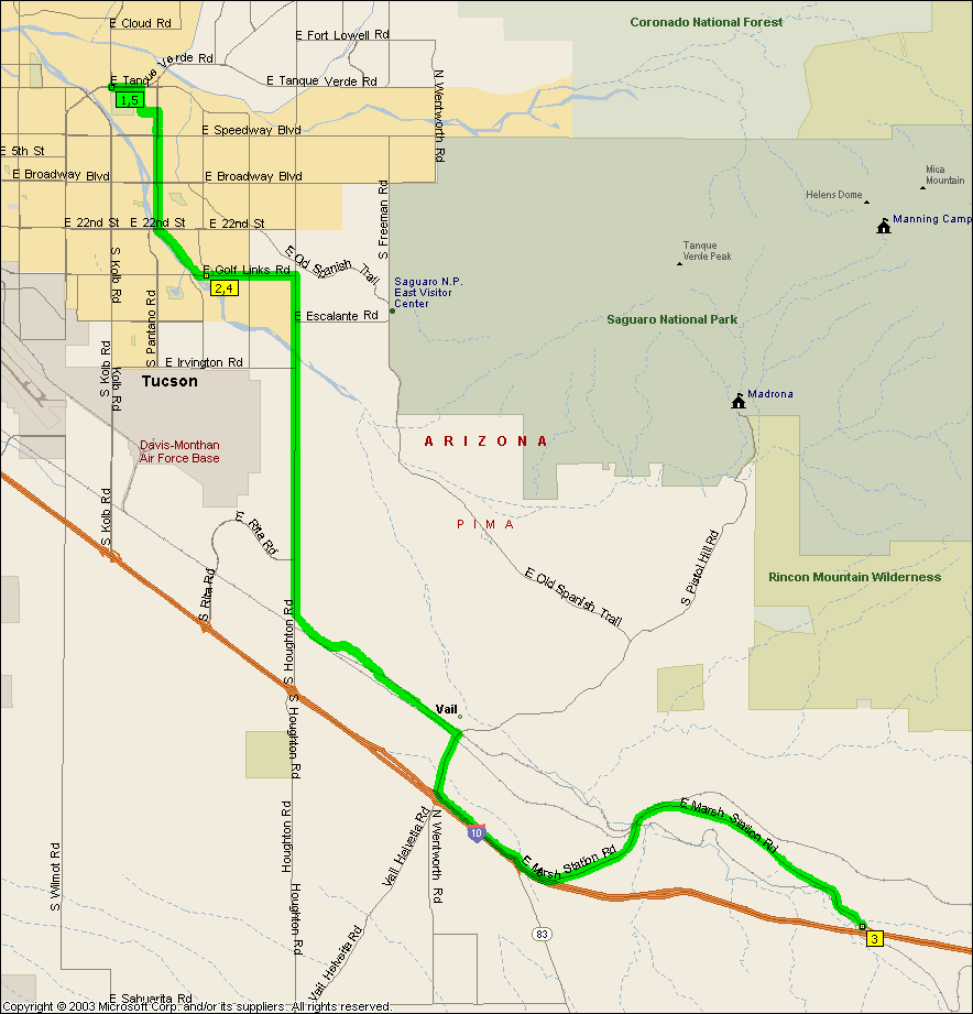
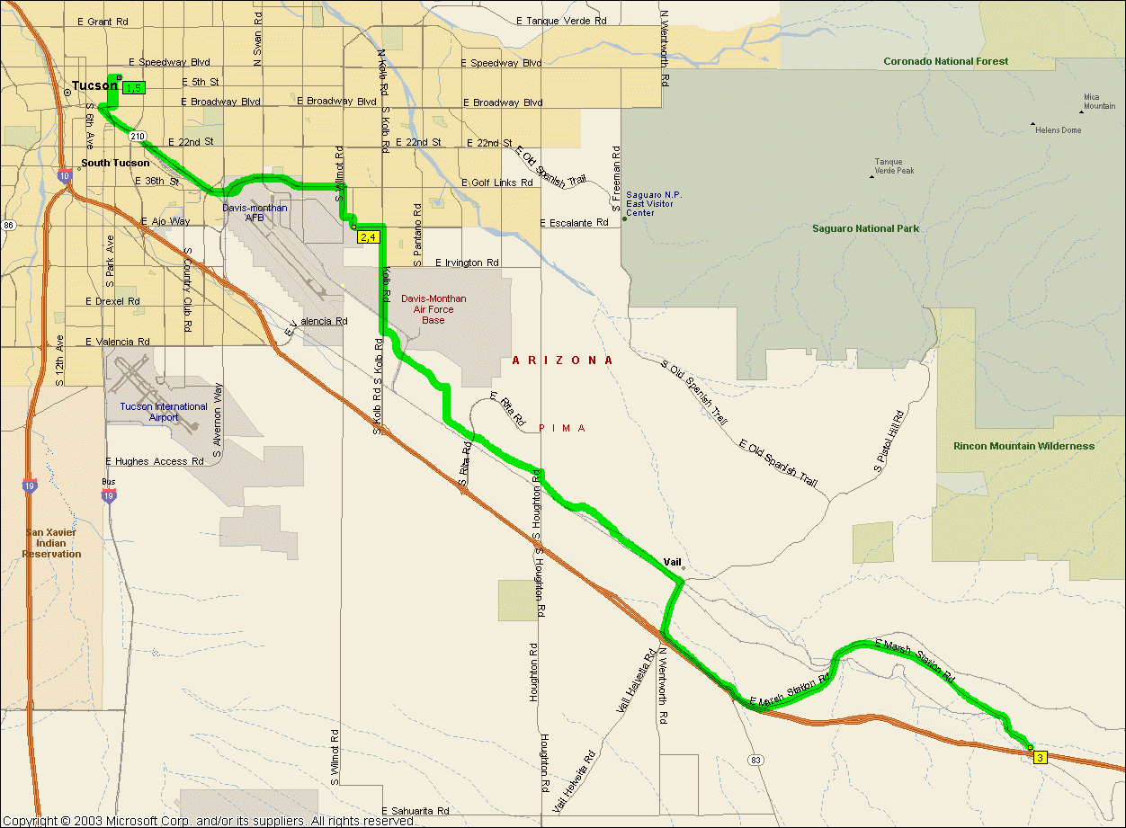
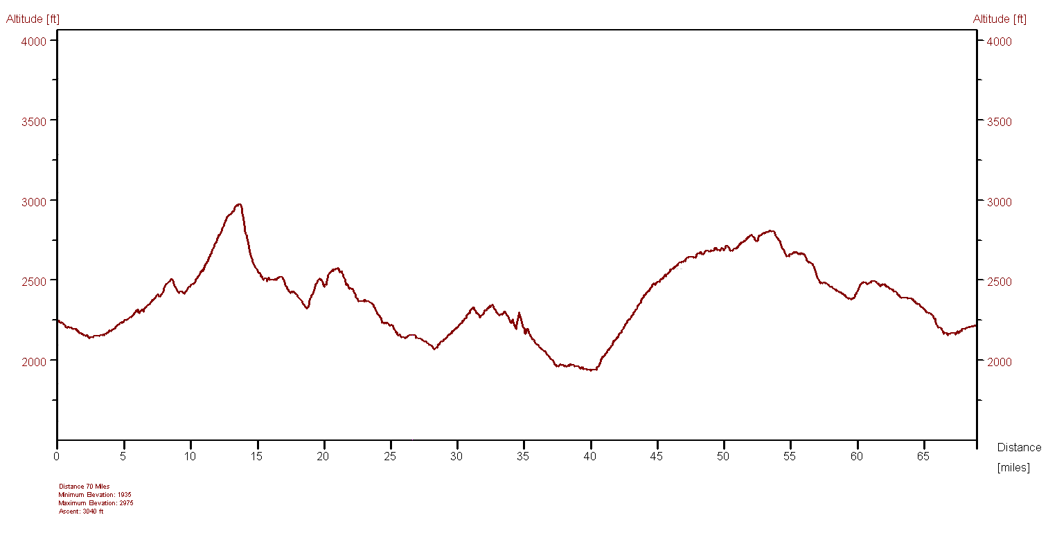
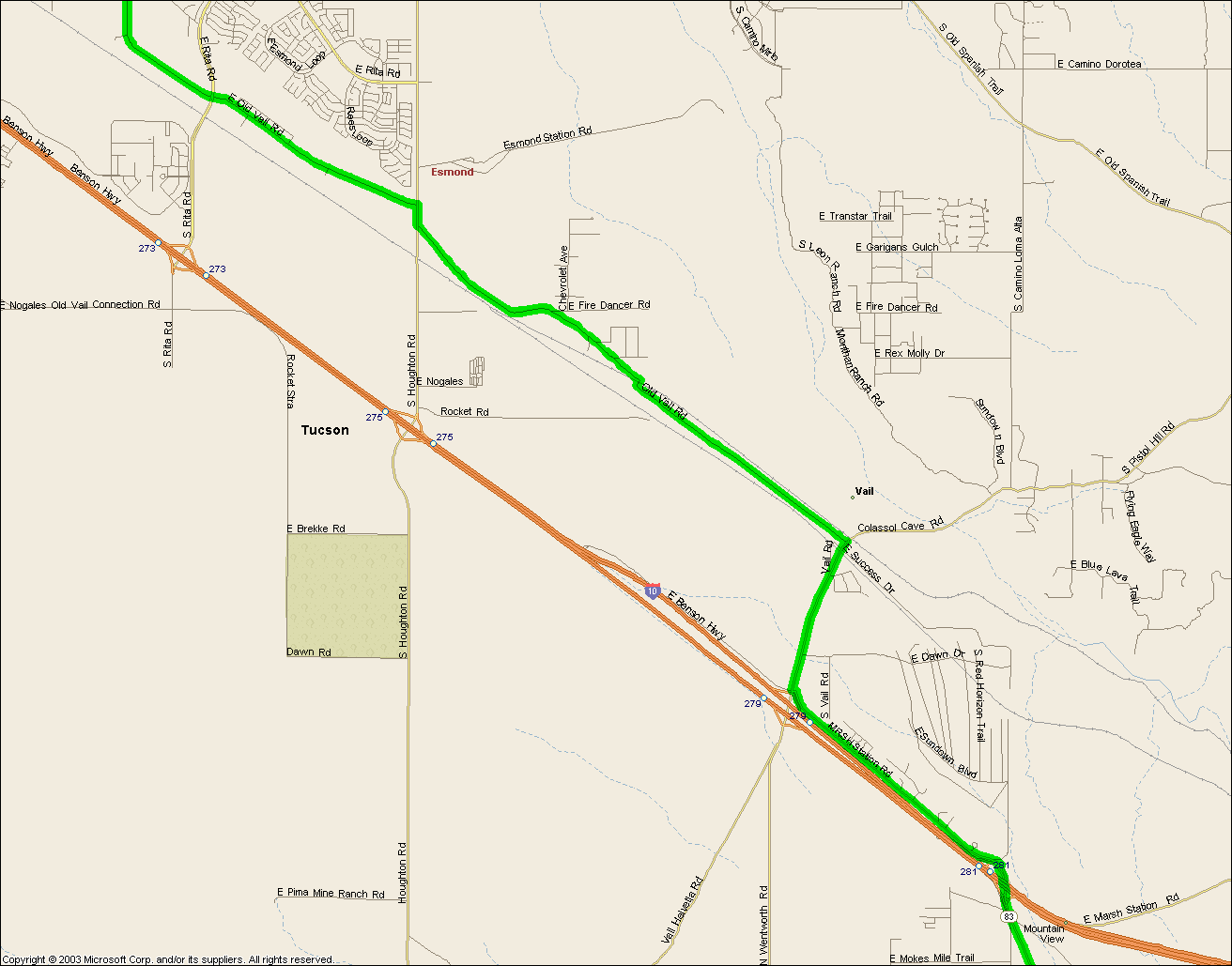
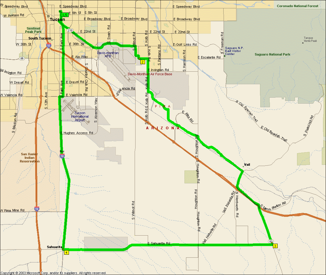
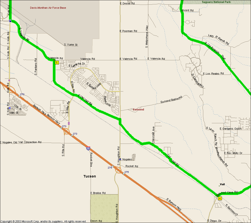
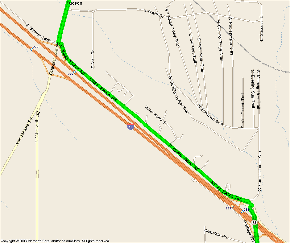
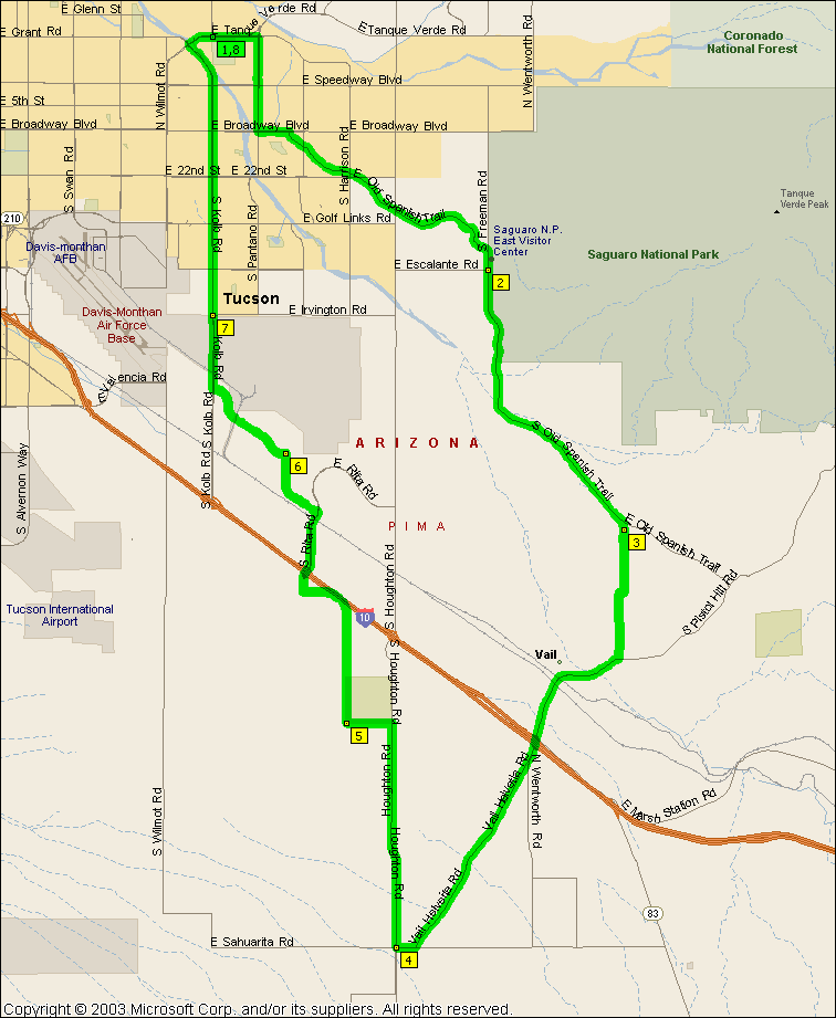
Once when Will and I were riding out to the bit of 83 on the
Vail and Corona
ride as we turned south onto 83 we could see people to the east off in the
distance riding on Marsh Station road so we figured perhaps it went somewhere.
Wrong. But it's still a nice ride,
check that elevation out, snakes alive, up and down like a freaking roller
coaster. An easier ride is the 64.6 mile
New Ride that has substantially easier climbing until you get to Vail,
from campus it's 72.5 miles.
|
|
|
|
|
| |
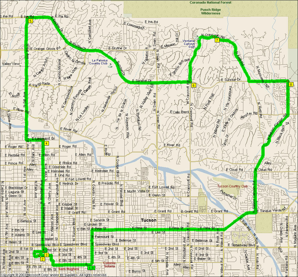
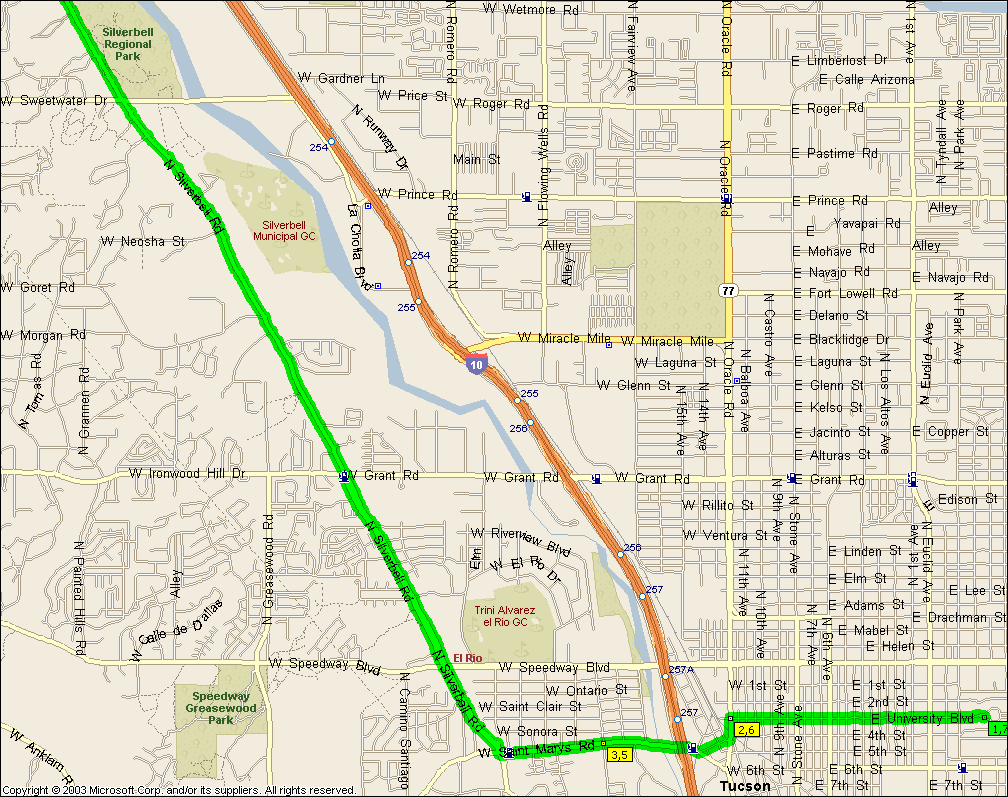
From Saguaro Monument West to Saguaro
Monument East this is one big ride, tons of hills and plenty of distance.
It's also a solo route with a little care as it's bit of a stretch getting to Sabino Canyon without topping up at the Visitor Center in the Saguaro Monument
West (the Red Hills Visitor Center on the map).
NOTE: It's not intended that you ride Aviation Parkway, you
should get on the bike path at Kolb and Escalante, cross over to the path on the
far side of the intersection at Craycroft and Golf Links and get off it at Highland and head north for campus.
|
|
|
|
|
| |
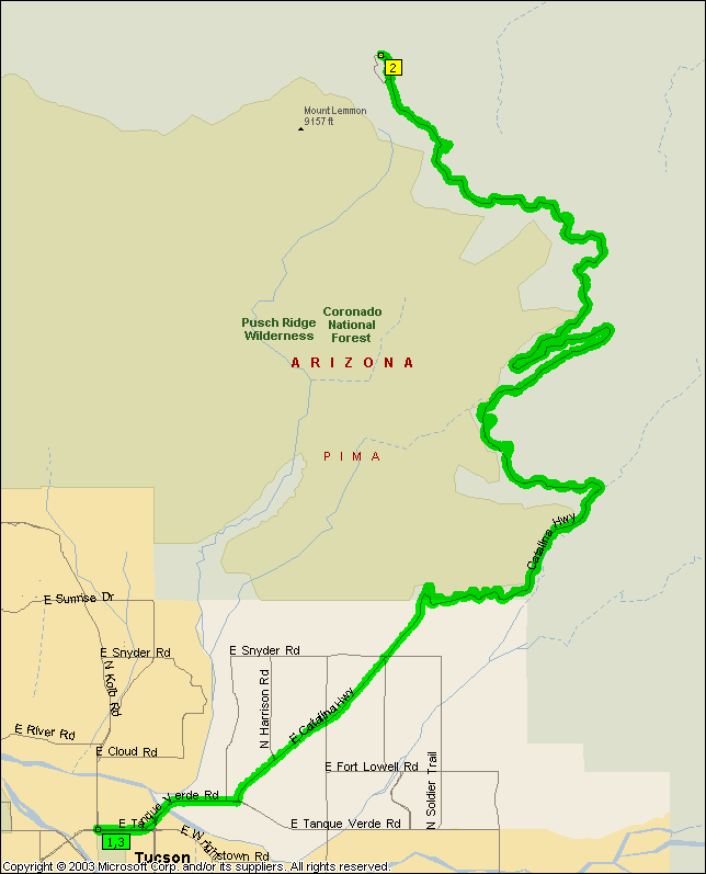
Like any of us are actually gonna get all the way up this thing -- well, Will
might have but then he's almost half my age so that tells you something. In the
summer you run out of fluids (although I hear there's water at Prison Camp which
would make the water higher up within conceivable reach) and in the winter it's
covered in snow and ice. But the bottom part in summer sure is a cool
ride, the desert is very pretty and soon enough it actually gets physically
cool. Plus screaming down the thing is an experience in itself, I'm
typically peaking out at 48 mph on the
'bent.
|
|
|
|
|
| |
Not that it covers any new ground but it sticks two of my favorites together
and avoids Silverbell. And it goes up and down like a
banshee, up Gates Pass, down to Avra, up
Picture Rocks, down to the Santa Cruz, up to Oracle, down back to Tucson.
Dunno why I didn't think of it earlier...
NOTE: Only rideable in the clockwise direction -- unless
of course you like riding the wrong way down the one way section of the Casa
Grande hwy. And then of course there's riding Camino de Manyana and dodging it's
potholes at uphill speeds as opposed to downhill speeds...
|
|
|
|
|
| |
NOTE: Only rideable in the clockwise direction -- unless
of course you like riding the wrong way down the one way section of the Casa
Grande hwy. And then of course there's riding Camino de Manyana and dodging it's
potholes at uphill speeds as opposed to downhill speeds...
|
|
|
|
|
| |
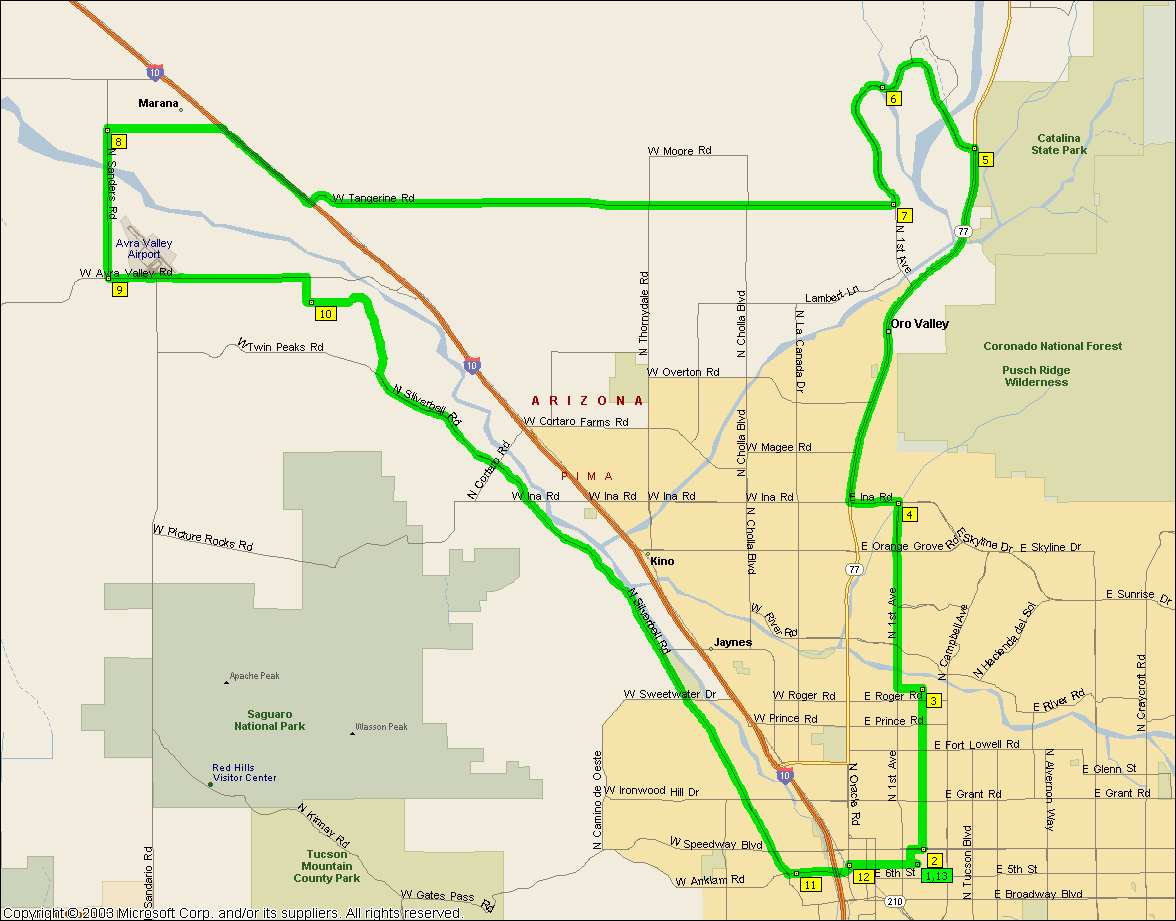
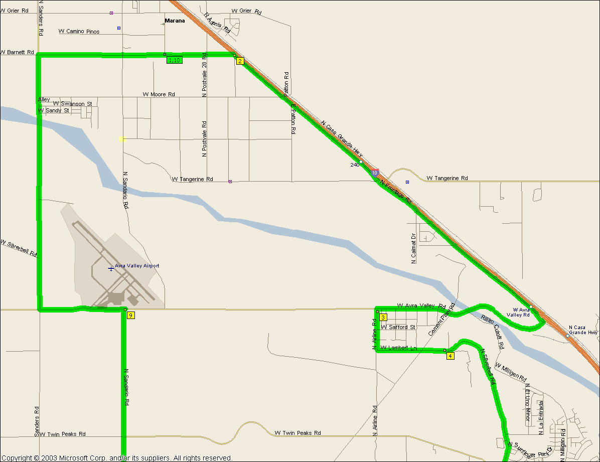
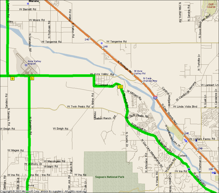
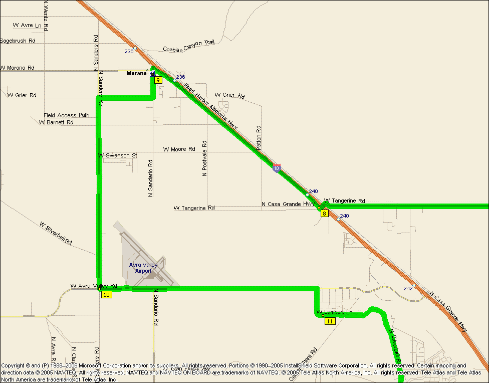
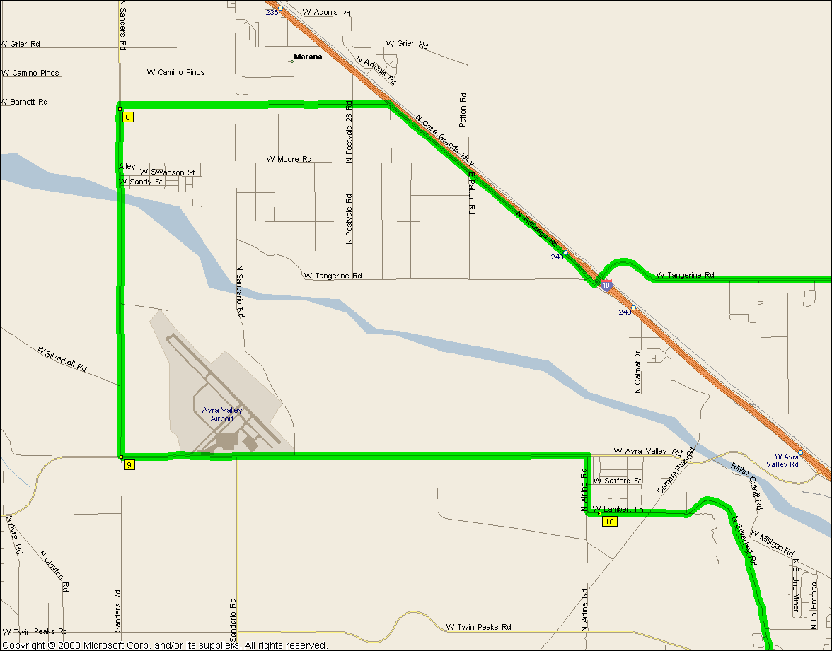
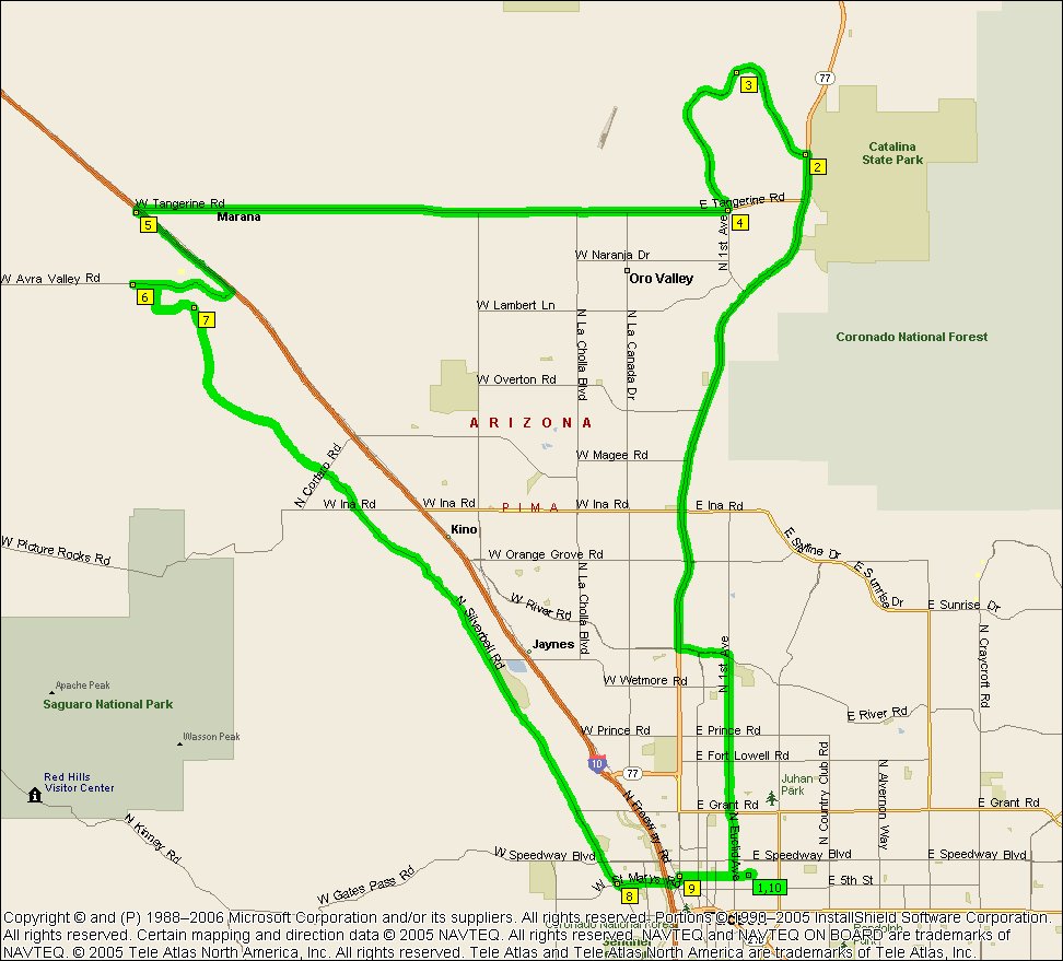
What with Tangerine having good shoulders down most of it these days and
Rancho Vistoso having water on it and Marana Valley's civic center this becomes
a fine solo route. And if you're not in solo mode there's a
Circle K in Marana that adds a couple of miles to the ride.
|
|
|
|
|
| |
NOTE: It's not intended that you ride that mess of back streets along River
between La Cholla and Orange Grove, River actually gets through these days
(MapPoint isn't up to date), just keep going along River...
|
|
|
|
|
|
_files/image_map.gif)
| |
This is the ride the real cyclists do early every Saturday morning
(see http://www.fwrt.org/ or
http://www.fairwheelbikes.com/ for
times) and
if you can hang with them you're really good, like Cat 3 good -- the rest of us
try to not get dropped too damn soon. If you can make it to the cattle grid
without getting dropped there's hope for you, if you make it to the bridge
you're getting there and might want to see the
short
version of the shootout. Mission's getting a little beat up these days
but the ride up behind Helmet Peak is superb. In the summer we'll usually
detour down
Continental Blvd. to the gas station for fluids, stretches the ride out to
63.4 miles.
|
|
|
|
|
_files/image_map.gif)
| |
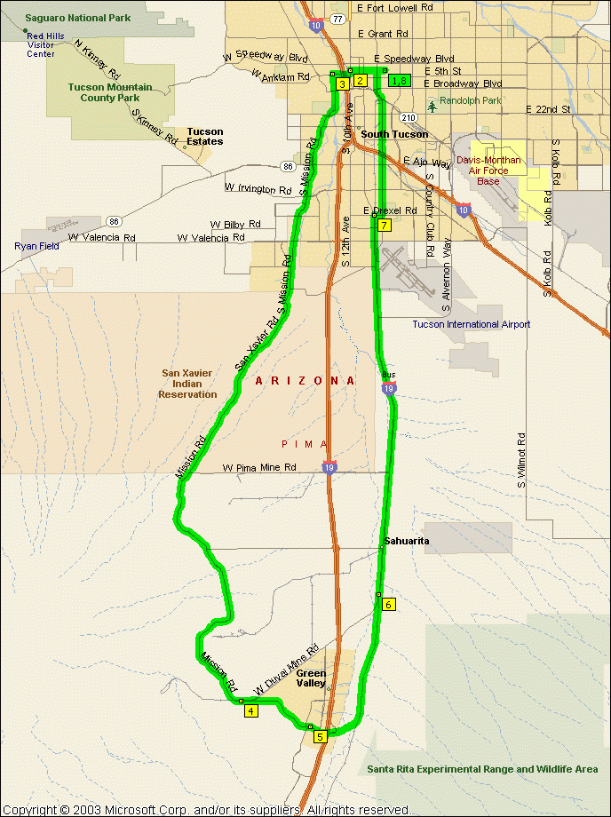
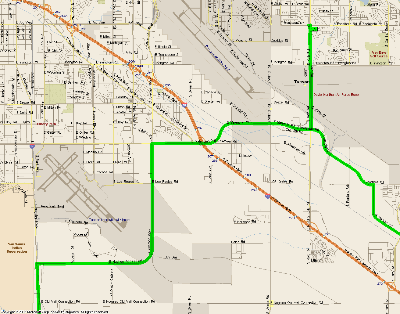
For those of you that are nearly real cyclists you can bolt down Helmet Peak
road after the
main
shootout peloton has dropped you and catch them as they fly up I-19 Bus.
If you could cut down Pima Mine Rd then the ride becomes a 44.4 mile affair but
I think MapPoint is once again missing a crucial bit of information here as
there's no Pima Mine Rd intersecting with Mission going east. West, for
sure, but not east.
|
|
|
|
|
| |
Watch out for the top of Continental blvd coming down, you'll be doing some
high speed pot hole dodging...
The very top of Madera Canyon has water and restrooms.
|
|
|
|
|
| |
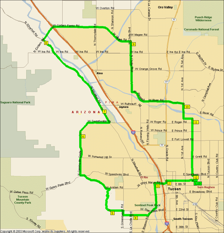
Only bad thing about this ride is the narrowness of Thornydale and Tangerine
(although I notice Tangerine has luuuhvely shoulder along most of it
nowadays). For that matter sections of Silverbell are none to damn wide
either but the traffic is slower along Silverbell and somehow it just ain't as
plain intimidating as Thornydale is. Best to try and do this when there's damn all traffic on the roads.
NOTE: It's not intended that you ride Aviation Parkway, you
should get on the bike path at Kolb and Escalante, cross over to the path on the
far side of the intersection at Craycroft and Golf Links and get off it at Highland and head north for campus.
NOTE: It's not intended that you ride that mess of back streets along River
between La Cholla and Orange Grove, River actually gets through these days
(MapPoint isn't up to date), just keep going along River...
|
|
|
|
|
|
| |
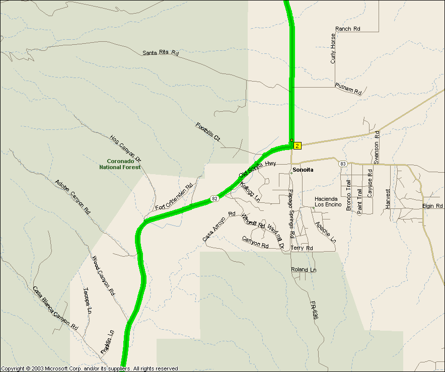
This one's a hill climb special and it'll kick your ass -- it certainly kicks
ours, to quote Eric half way to Sonoita "Whose idea was this anyway?" You start out lightly climbing out
of Tucson, past Corona De Tucson and then you climb out Route 83 and then after
a while you start really climbing -- and climbing -- and climbing. If that
wasn't bad enough you're still something like 10 miles out of Sonoita and you
see the 1 mile of 5% grades sign -- downhill -- which means you've got to climb
it going back, argh. But after a stop in Sonoita the 1 mile climb is
trivial and then you get to see the sign that tells you the last 4 miles of
uphill on ride out there was up 6% grades and boy do you feel good. And
it's downhill all the way home...
Oh yeah, you'll want to turn off your cell phone. There's nothing in
the way of towers between Tucson and Sonoita (although Sonoita itself has one)
and if your battery is a little anemic it'll be flat by the time you get to
Sonoita.
And now that they've paved the Old Vail Rd. you can carve a bit off the ride
going through Vail instead of Corona de Tucson shaving it down to
84.7 miles (104.2 from campus).
|
|
|
|
|
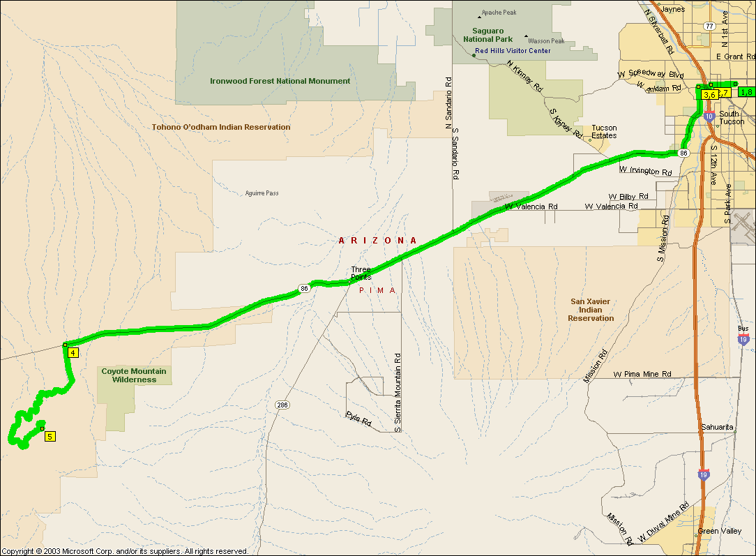
| |
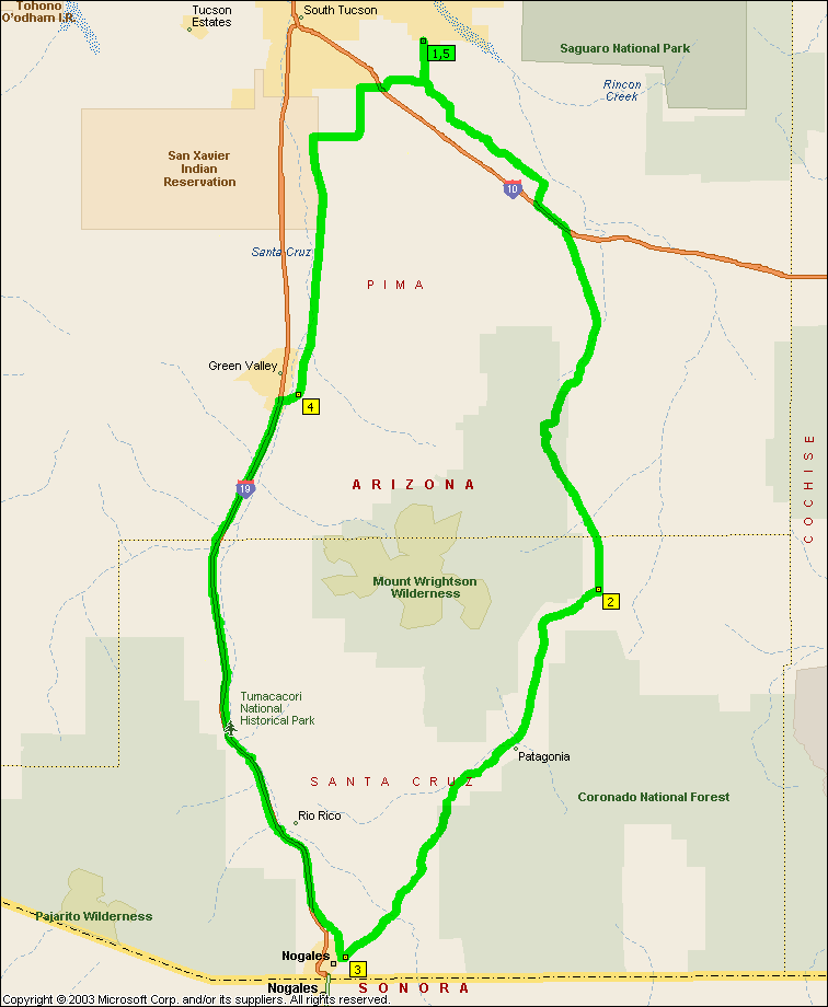
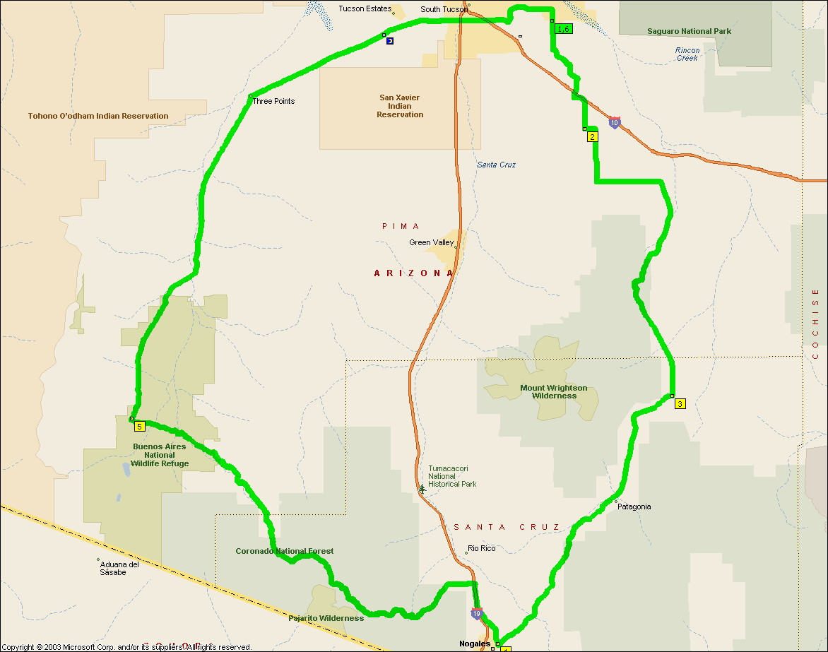
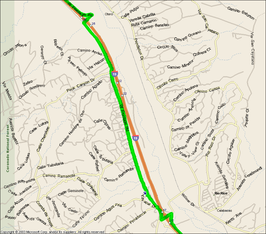
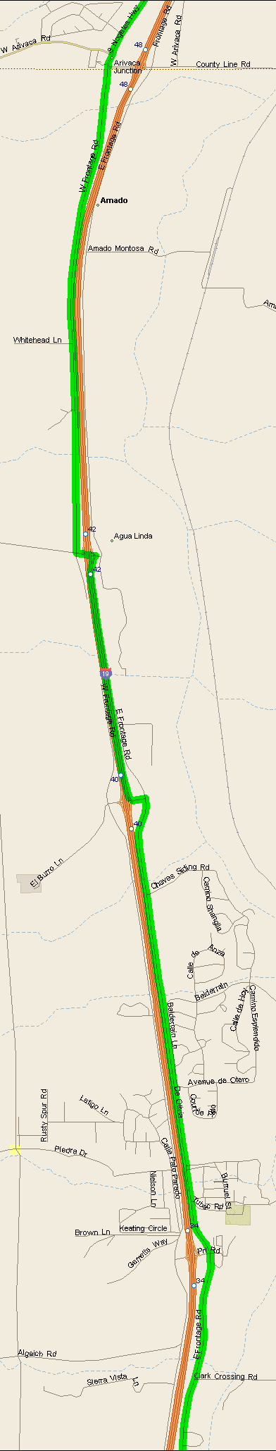
You've got to ride along I-19 there in Tubac between exits 40 and 42 (which
the
Tumacacori has to do so it can't be that bad) but it's the next big ride we
do. To avoid I-19 the alternative is to
swing out through
Arivaca and Three Points, however that's 194.7 miles
and that's a bridge that's too damn far (not to mention having 20 or so miles of really rough dirt road between Nogales and Arivaca).
|
|
|
|
|
| |
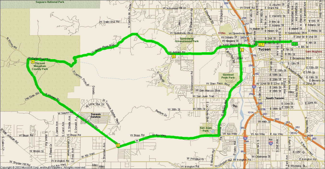
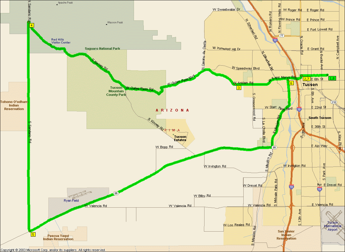
Watch out for the Gates Pass hill. After the Kolb loop, Picture rocks
and climbing Kinney the really steep half mile or so of 12 % grade just before
Gates Pass is pure torture. For a much easier ride take
Kinney south to Ajo which'll make the ride 64.7 miles.
|
|
|
|
|
| |
The west loop is 37.7 miles and the east one
20.3 miles.
NOTE: It's not intended that you ride that mess of back streets along River
between La Cholla and Orange Grove, River actually gets through these days
(MapPoint isn't up to date), just keep going along River...
|
|
|
|
|
| |
A bit of stretch for a solo route until I realized Ajo Bikes was there on Ajo
and Benson so if you take Ajo instead of Irvington this is another solo
candidate. If you lop
Kolb off and take 22nd home (not really recommended) the route drops to
59.1 miles.
|
|
|
|
|
|

| |
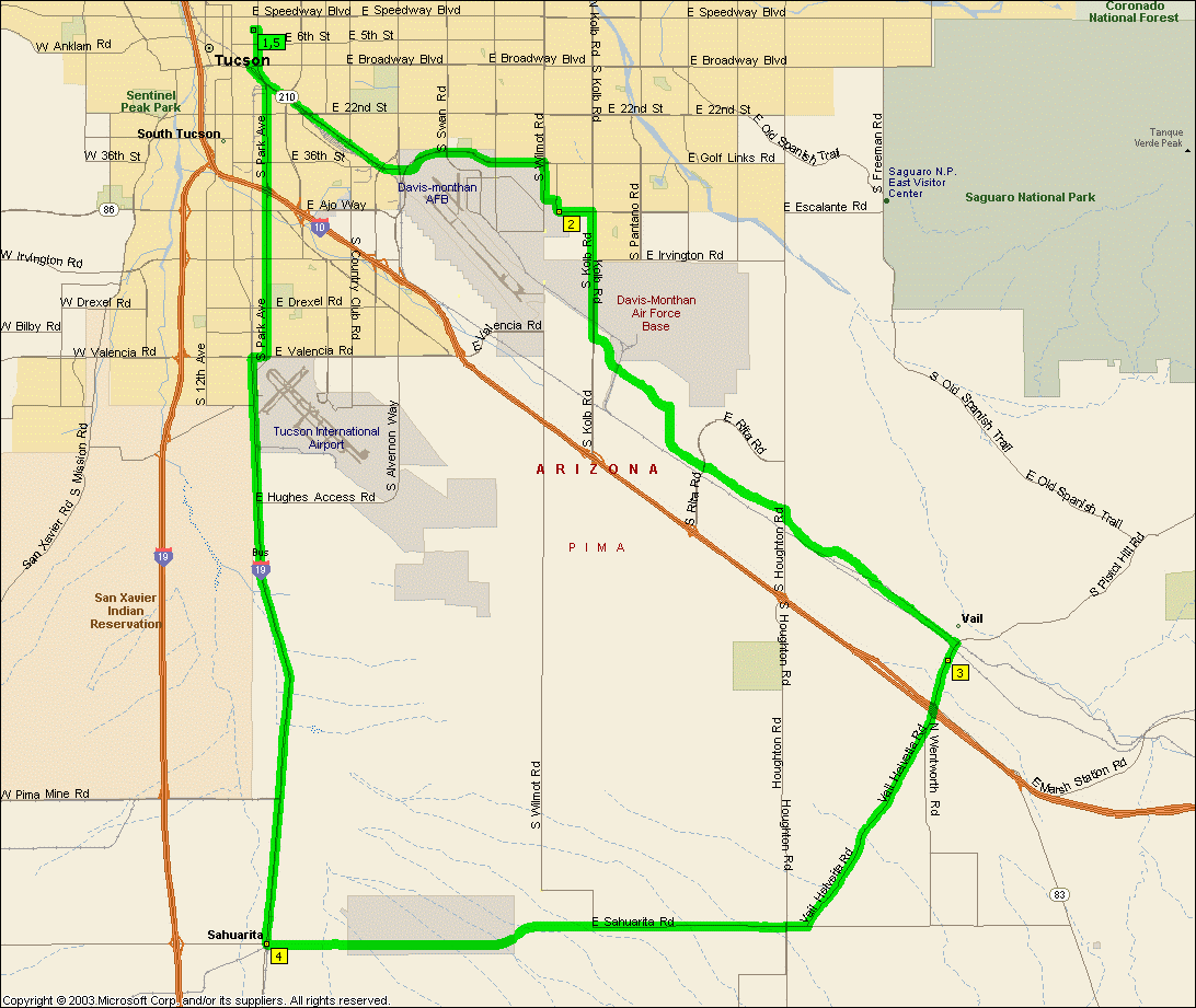
What with Old Vail rd. being paved to Vail now a new way to avoid Houghton
avails itself and thus this ride is born. If you
truncate the SE corner and ride straight from Vail to Corona it drops to
71.3 miles. If you use
I-19 Bus instead of Mission it drops to 66.4 miles
and if you use
I-19 on the truncated route it drops to 60.7 miles.
You can tell we get people worried about riding too far can't you?
NOTE: It's not intended that you ride Aviation Parkway or Golf Links etc, you
should take Highland south from campus and get on the bike path and take it east, cross over to the path on the
other side at Craycroft and Golf Links and off it Kolb and Escalante.
|
|
|
|
|
| |
This ride combines some of the prettiest bits of Tucson for riding with some
of the ugliest. Out Gates Pass and the McCain Loop is a very pretty climb
through the desert and along Irvington and Benson Hwy is usually a grind into
the breeze through some butt ugly bits of the city. Then the bit of Kolb
through the base and the bits of Aviation bikeway are nice again. You can
extend it out
Sandario for a 71.5
mile ride.
NOTE: It's not intended that you ride Aviation Parkway, you
should get on the bike path at Kolb and Escalante, cross over to the path on the
far side of the intersection at Craycroft and Golf Links and get off it at Highland and head north for campus.
|
|
|
|
|
|
|
| |
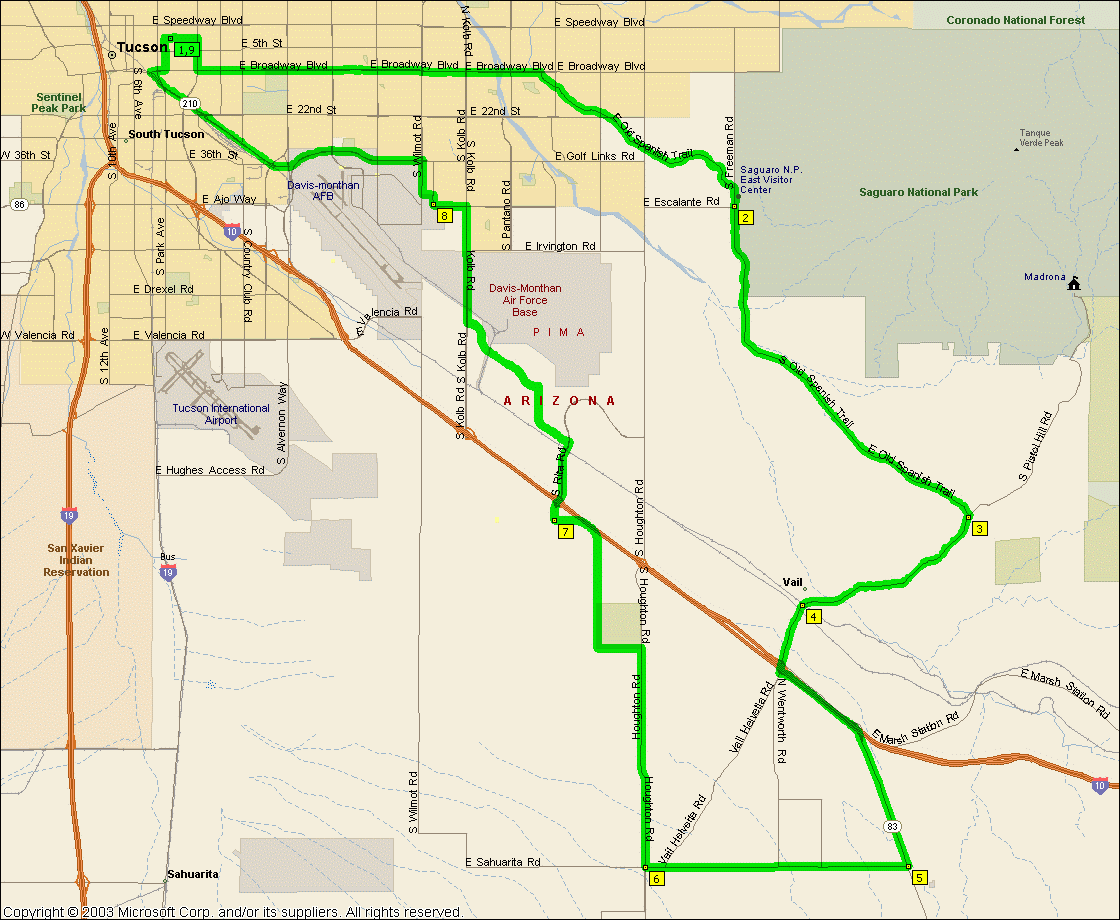
They've paved the Old Vail road so
a short ride around Vail becomes an option now, wahoo! But of course
MapPoint doesn't have the new road in there, while it's Old Vail rd. at Houghton
(albeit a couple of hundred yards further north than indicated) it's Cinega (or
something) High School Rd (that's still posted as a no through road) that's next
to the elementary school that's on the north side of the northern set of railway
tracks. It's 52.7 miles
from campus.
NOTE: Only pleasant to ride in the clockwise direction
as the fast bits of Pistol Hill Rd. are along nice bits of pavement whereas the
other way you're going fast down a really rugged bit of pavement...
|
|
|
|
|
| |
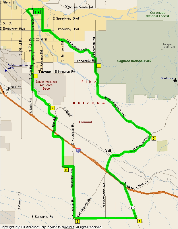
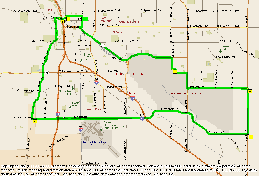
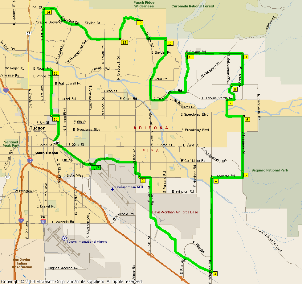
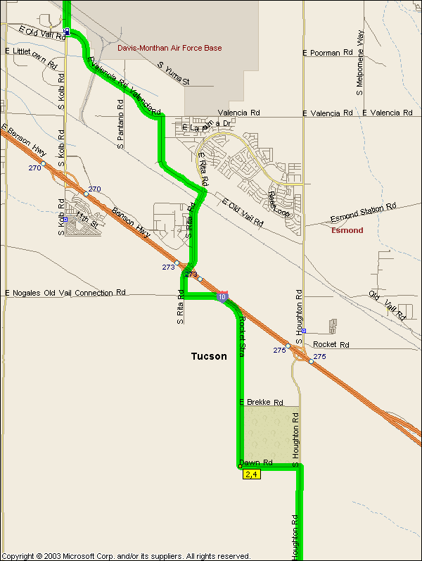
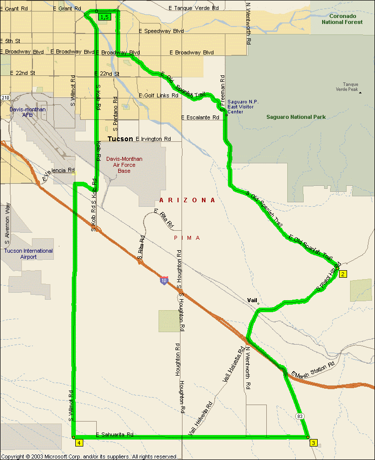
A nice ride out Old Spanish Trail with an added climb out the first bit of
route 83 to Sonoita (70.4 miles from
campus). Houghton can be a bit of a pain coming home which is
why you bail off it at Dawn Rd., but it's too nice a ride to let Houghton be
reason not to ride it. If you
chop Pistol Hill and route 83 off it drops to 52.0 miles.
If they ever pave Wilmot it would open up
a 63.8 mile
Houghton alternative, however it's still just hard packed dirt.
NOTE: Only pleasant to ride in the clockwise direction
as the fast bits of Pistol Hill Rd. are along nice bits of pavement whereas the
other way you're going fast down a really rugged bit of pavement...
|
|
|
|
|
| |
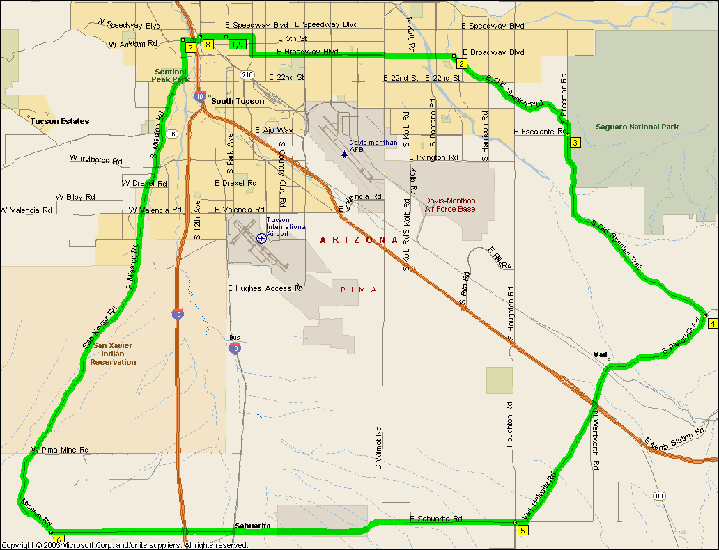
Got some classic Tucson bike riding roads on this one, Old Spanish trial has
some hills to climb is generally a very pretty piece of road to ride out and
Mission coming home is equally scenic. Got a bit of a hill to climb here
and there so all in all a very nice longish ride.
NOTE: Only pleasant to ride in the clockwise direction
as the fast bits of Pistol Hill Rd. are along nice bits of pavement whereas the
other way you're going fast down a really rugged bit of pavement...
|
|
|
|
|
| |
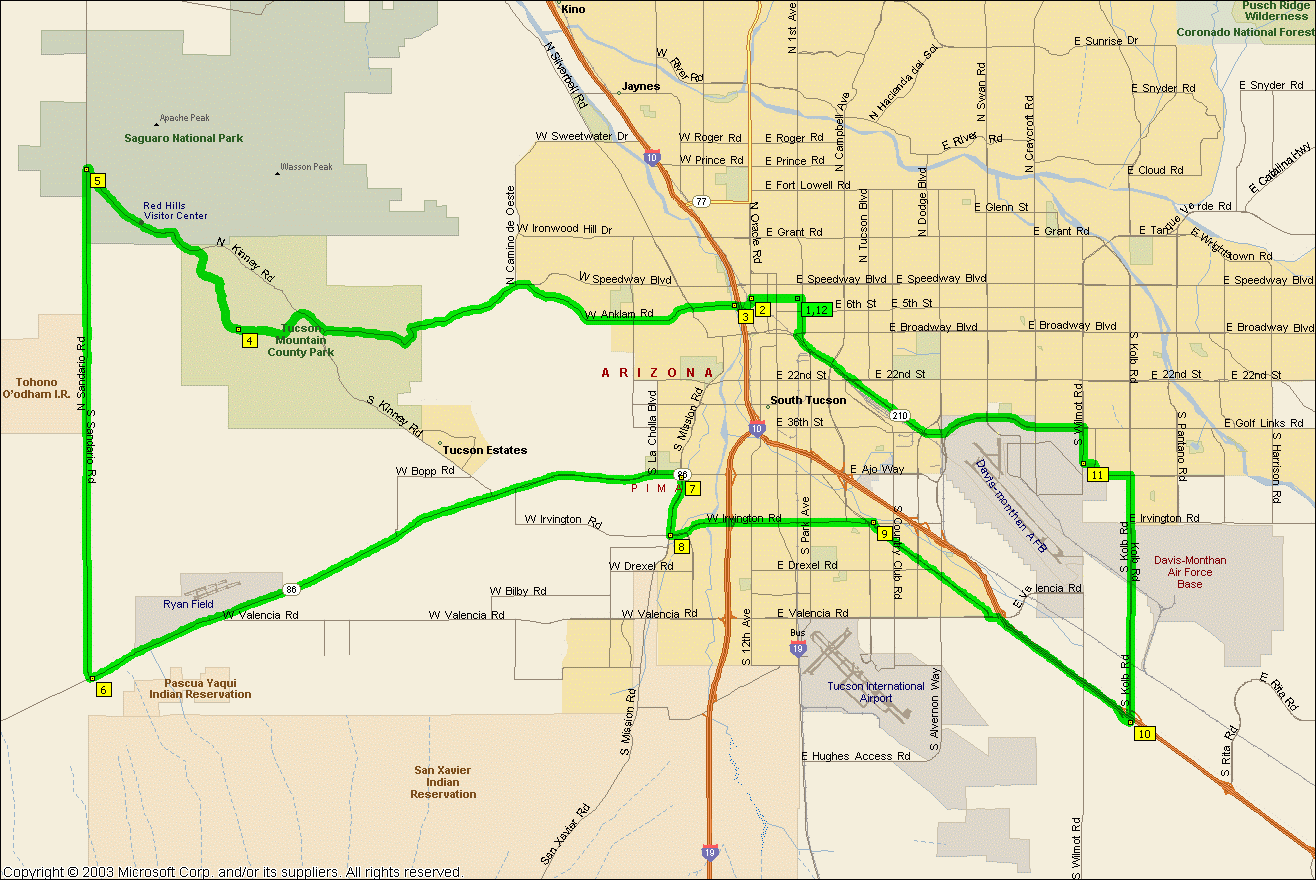
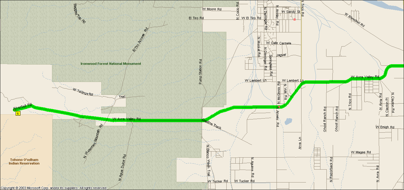
In Eric's words, "an excellent workout".
Avra Valley Rd is an amazingly nice piece of road for something that appears to
go nowhere and the shoulders are second to none. Till the far west end at
least, then it gets a little rough as you climb out to the mine but
it's still rideable. The Ironwood Forest is very scenic and eerily quiet
-- which might depend on whether the mine is active when you're there I guess. There's a store at Anway and Avra
Valley for fluids. If you want more you can
start out over Gates Pass for a 85.3 mile ride
that's gonna kick most people's ass...
|
|
|
|
|
| |
NOTE: It's not intended that you ride Aviation Parkway or Golf Links etc, you
should take Highland south from campus and get on the bike path and take it east, cross over to the path on the
other side at Craycroft and Golf Links and off it Kolb and Escalante.
NOTE: Only rideable in the clockwise direction -- unless
of course you like riding the wrong way down the one way section of the Casa
Grande hwy. And then of course there's riding Camino de Manyana and dodging it's
potholes at uphill speeds as opposed to downhill speeds...
|
|
|


_files/Detour%20for%20fluids.gif)